Valley circular trail
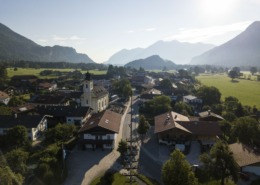
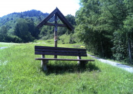
Valley circular trail - hiking trail to get to know our valley and the surrounding mountains. Rest benches invite you to enjoy the view of the surrounding mountain peaks.

Valley circular trail - hiking trail to get to know our valley and the surrounding mountains. Rest benches invite you to enjoy the view of the surrounding mountain peaks.
distance
duration
highest point
meters upwards
meters downwards
Difficulty
easy
Circular route symbol: Hirsch Tal-Rundweg. Refreshment options: Pizzeria Raggio di Sole; Raitener Wirt; Landgasthof “Zur Post”; Wuhrsteinhaus; Gasthof Geigelstein. Special features: Achendammweg; Kneipp facility in Raiten, pilgrimage church “Maria zu den sieben Linden”, swimming at Lake Zellersee. Description: From the car park at the tourist information office in Schleching, head south for 200 metres along the main road, then cross it on the left and always follow the deer symbols north-east to Achendammweg, then left towards Mühlau to the Mühlbach bridge, then left again towards the main road. Shortly before that, turn right towards Raiten and follow a forest path to Raiten. Here you can refresh your feet in the Kneipp facility and your throat at the Raitener Wirt. Continue to the pilgrimage church “Maria zu den sieben Linden” and towards Hinterraiten and Mettenham. Halfway there, turn right towards Lake Zellersee past the campsite. Here you can take a swim in Lake Zellersee, or make a detour to the “Filzenblick” before continuing towards Mühlau. Pass the Zellerwand climbing garden until you reach the road downhill to Mettenham, where a shady path leads towards Mühlau (not via Mettenham). In Mühlau, cross the Mühlbach left, right, right, left, always towards Schleching. From the road towards Schleching, a footpath soon branches off to the right towards the Austrasse hiking car park. After 400 metres, turn left back to Schleching. Achental hiking pin checkpoints: Tourist information, Raiten, Filzenblick.
Senioren geeignet
Einkehrmöglichkeit
Touristik-Information , Schleching
 https://www.achental.com/en/storage/sites/10/2025/06/51253_DSC00673_1920x1278.jpg
1278
1920
admin
https://www.achental.com/wp-content/uploads/2022/07/achental-logo-weiss-horizontal-RGB@2x.png
admin2025-04-30 09:21:342025-06-07 11:02:26Circular tour Grassauer Almen
 https://www.achental.com/en/storage/sites/10/2025/06/OqqtL2ddEOAljbylKsbGYuTNgwTs5VV03aCmQVk7.jpg
1707
2560
admin
https://www.achental.com/wp-content/uploads/2022/07/achental-logo-weiss-horizontal-RGB@2x.png
admin2025-04-24 01:08:072025-06-07 11:05:29Schmugglerweg to Kössen
 https://www.achental.com/en/storage/sites/10/2025/06/DBEUmwDZxqIa552KGtY7FRaBDy2zuyT3CSJVxLhF.jpg
1705
2560
admin
https://www.achental.com/wp-content/uploads/2022/07/achental-logo-weiss-horizontal-RGB@2x.png
admin2025-04-24 01:08:062025-06-07 11:06:06Schmugglerweg to Klobenstein
 https://www.achental.com/en/storage/sites/10/2025/06/sI0JyHhoSTI8r8TCYiee1ydZojiMieRrirnifIF6.jpg
1707
2560
admin
https://www.achental.com/wp-content/uploads/2022/07/achental-logo-weiss-horizontal-RGB@2x.png
admin2025-04-14 01:03:572025-06-07 10:40:03Auf historischen Pfaden
 https://www.achental.com/en/storage/sites/10/2025/06/gzzxtE26tAeHfOmQ2Py2gP7DoMAzPHJDquWDsptw.jpg
1707
2560
admin
https://www.achental.com/wp-content/uploads/2022/07/achental-logo-weiss-horizontal-RGB@2x.png
admin2025-04-09 01:11:092025-06-07 11:19:46Schnappenberg – Schnappenkirche
 https://www.achental.com/en/storage/sites/10/2025/06/byrz9Rdu4oAN0l849tnGJuWZPJQwfDPf8187HMNO.jpg
1707
2560
admin
https://www.achental.com/wp-content/uploads/2022/07/achental-logo-weiss-horizontal-RGB@2x.png
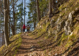
admin2025-04-09 01:11:092025-06-07 11:09:51Circular hike: Staudacheralm – Schnappenkirche
 https://www.achental.com/en/storage/sites/10/2025/06/UkMX7jlNtUgz7DUN7zw7n8VZWRoafD2XjJtGyatW.jpg
1919
2560
admin
https://www.achental.com/wp-content/uploads/2022/07/achental-logo-weiss-horizontal-RGB@2x.png
admin2025-02-24 01:06:162025-06-07 10:49:27Valley circular trail
 https://www.achental.com/en/storage/sites/10/2025/06/9VruSXPV8ePSxZlnGpViGMZqYnWT2WmVj6N21gVK.webp
768
576
admin
https://www.achental.com/wp-content/uploads/2022/07/achental-logo-weiss-horizontal-RGB@2x.png
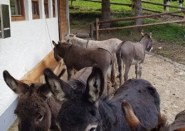
admin2025-02-19 01:04:142025-06-07 10:45:19Feldlahnalm tour
 https://www.achental.com/wp-content/uploads/2022/07/achental-logo-weiss-horizontal-RGB@2x.png
0
0
admin
https://www.achental.com/wp-content/uploads/2022/07/achental-logo-weiss-horizontal-RGB@2x.png
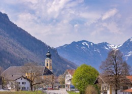
admin2025-01-01 01:04:262025-06-07 11:13:58Lake Taubensee via Luftboden- and Kroatensteig
https://www.achental.com/wp-content/uploads/2022/07/achental-logo-weiss-horizontal-RGB@2x.png
0
0
admin
https://www.achental.com/wp-content/uploads/2022/07/achental-logo-weiss-horizontal-RGB@2x.png
admin2025-01-01 01:04:262025-06-07 11:13:58Lake Taubensee via Luftboden- and Kroatensteig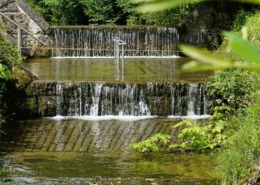 https://www.achental.com/en/storage/sites/10/2025/06/dnnXUqmOoT9qsZJ2w9KjLhaU9rm1fN1Pzba35MkA.jpg
1500
1000
admin
https://www.achental.com/wp-content/uploads/2022/07/achental-logo-weiss-horizontal-RGB@2x.png
admin2025-01-01 01:04:242025-06-07 10:55:06Kneipp circular tour
 https://www.achental.com/wp-content/uploads/2022/07/achental-logo-weiss-horizontal-RGB@2x.png
0
0
admin
https://www.achental.com/wp-content/uploads/2022/07/achental-logo-weiss-horizontal-RGB@2x.png
admin2025-01-01 01:04:232025-06-07 11:01:38Rundweg Schnappenwinkl – Staudach
https://www.achental.com/wp-content/uploads/2022/07/achental-logo-weiss-horizontal-RGB@2x.png
0
0
admin
https://www.achental.com/wp-content/uploads/2022/07/achental-logo-weiss-horizontal-RGB@2x.png
admin2025-01-01 01:04:232025-06-07 11:01:38Rundweg Schnappenwinkl – Staudach https://www.achental.com/wp-content/uploads/2022/07/achental-logo-weiss-horizontal-RGB@2x.png
0
0
admin
https://www.achental.com/wp-content/uploads/2022/07/achental-logo-weiss-horizontal-RGB@2x.png
admin2025-01-01 01:04:222025-06-07 10:46:09River and moor hike through the Achental
https://www.achental.com/wp-content/uploads/2022/07/achental-logo-weiss-horizontal-RGB@2x.png
0
0
admin
https://www.achental.com/wp-content/uploads/2022/07/achental-logo-weiss-horizontal-RGB@2x.png
admin2025-01-01 01:04:222025-06-07 10:46:09River and moor hike through the Achental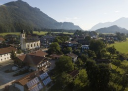 https://www.achental.com/en/storage/sites/10/2025/06/VVT8YD8z5ZEAzoiXkshUne9HdSbxdwHaAkTvV3bW.jpg
1919
2560
admin
https://www.achental.com/wp-content/uploads/2022/07/achental-logo-weiss-horizontal-RGB@2x.png
admin2025-01-01 01:04:212025-06-07 10:48:46Grießelberg-Rundweg
 https://www.achental.com/en/storage/sites/10/2025/06/89256_DSC00025.jpg
1536
2048
admin
https://www.achental.com/wp-content/uploads/2022/07/achental-logo-weiss-horizontal-RGB@2x.png
admin2025-01-01 01:04:192025-06-07 11:01:24Circular hike Hinterwössen
 https://www.achental.com/en/storage/sites/10/2025/06/oVwKyuBPBxd4hb8dx2dB9cYkwxVcsjkJrcGgNKx1.jpg
543
768
admin
https://www.achental.com/wp-content/uploads/2022/07/achental-logo-weiss-horizontal-RGB@2x.png
admin2025-01-01 01:04:182025-06-07 10:47:04Geigelstein parking lot to Breitenstein via Karl – to Walchsee
 https://www.achental.com/en/storage/sites/10/2025/06/wMi70NWgXiYlIFKkdOOpZl1UsbdCQKVH0V6cl5Ni.jpg
1707
2560
admin
https://www.achental.com/wp-content/uploads/2022/07/achental-logo-weiss-horizontal-RGB@2x.png
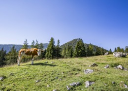
admin2024-12-30 01:04:102025-06-07 10:41:24Bergwalderlebnisweg Staffen with Hochplattenbahn cable car
 https://www.achental.com/en/storage/sites/10/2025/06/XQIxdrBep4hkkHo5ZkqtPoAaOrd6Xeszaw9QHE3g.jpeg
1080
1616
admin
https://www.achental.com/wp-content/uploads/2022/07/achental-logo-weiss-horizontal-RGB@2x.png
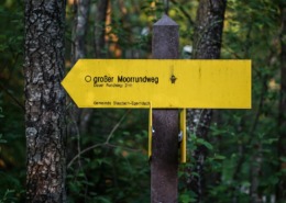
admin2024-12-30 01:04:092025-06-07 10:49:00Long Moorland Path
 https://www.achental.com/en/storage/sites/10/2025/06/KKX9UDoPV12aMw9wvyEJ367aiX6VkZbBz3SUeNbQ.jpg
1707
2560
admin
https://www.achental.com/wp-content/uploads/2022/07/achental-logo-weiss-horizontal-RGB@2x.png
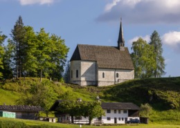
admin2024-12-30 01:04:092025-06-07 11:16:21Via Chiemhauseralm to church Streichenkirche
 https://www.achental.com/en/storage/sites/10/2025/06/65WXYhJdPWmJTz4k5TUHiKCTixL2EgZmb2hAPpa1.jpg
1919
2560
admin
https://www.achental.com/wp-content/uploads/2022/07/achental-logo-weiss-horizontal-RGB@2x.png
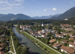
admin2024-12-30 01:04:082025-06-07 11:01:04Circular tour via Minaruh and Streunthal
 https://www.achental.com/en/storage/sites/10/2025/06/BB6c390WBwrPa41LKQngrCwHVl0PRm8DcXUWGi0u.jpg
1707
2560
admin
https://www.achental.com/wp-content/uploads/2022/07/achental-logo-weiss-horizontal-RGB@2x.png
admin2024-12-30 01:04:072025-06-07 11:17:54To Unterwössen along Tiroler Ache and Richard-Strauss Höhenweg )
 Trailrun – Hochgern summit via Staudacher Alm
 Achental - Chiemsee-Chiemgau holiday region
We firmly believe that the internet should be available and accessible to anyone, and are committed to providing a website that is accessible to the widest possible audience, regardless of circumstance and ability.
To fulfill this, we aim to adhere as strictly as possible to the World Wide Web Consortium’s (W3C) Web Content Accessibility Guidelines 2.1 (WCAG 2.1) at the AA level. These guidelines explain how to make web content accessible to people with a wide array of disabilities. Complying with those guidelines helps us ensure that the website is accessible to all people: blind people, people with motor impairments, visual impairment, cognitive disabilities, and more.
This website utilizes various technologies that are meant to make it as accessible as possible at all times. We utilize an accessibility interface that allows persons with specific disabilities to adjust the website’s UI (user interface) and design it to their personal needs.
Additionally, the website utilizes an AI-based application that runs in the background and optimizes its accessibility level constantly. This application remediates the website’s HTML, adapts Its functionality and behavior for screen-readers used by the blind users, and for keyboard functions used by individuals with motor impairments.
If you’ve found a malfunction or have ideas for improvement, we’ll be happy to hear from you. You can reach out to the website’s operators by using the following email
Our website implements the ARIA attributes (Accessible Rich Internet Applications) technique, alongside various different behavioral changes, to ensure blind users visiting with screen-readers are able to read, comprehend, and enjoy the website’s functions. As soon as a user with a screen-reader enters your site, they immediately receive a prompt to enter the Screen-Reader Profile so they can browse and operate your site effectively. Here’s how our website covers some of the most important screen-reader requirements, alongside console screenshots of code examples:
Screen-reader optimization: we run a background process that learns the website’s components from top to bottom, to ensure ongoing compliance even when updating the website. In this process, we provide screen-readers with meaningful data using the ARIA set of attributes. For example, we provide accurate form labels; descriptions for actionable icons (social media icons, search icons, cart icons, etc.); validation guidance for form inputs; element roles such as buttons, menus, modal dialogues (popups), and others. Additionally, the background process scans all the website’s images and provides an accurate and meaningful image-object-recognition-based description as an ALT (alternate text) tag for images that are not described. It will also extract texts that are embedded within the image, using an OCR (optical character recognition) technology. To turn on screen-reader adjustments at any time, users need only to press the Alt+1 keyboard combination. Screen-reader users also get automatic announcements to turn the Screen-reader mode on as soon as they enter the website.
These adjustments are compatible with all popular screen readers, including JAWS and NVDA.
Keyboard navigation optimization: The background process also adjusts the website’s HTML, and adds various behaviors using JavaScript code to make the website operable by the keyboard. This includes the ability to navigate the website using the Tab and Shift+Tab keys, operate dropdowns with the arrow keys, close them with Esc, trigger buttons and links using the Enter key, navigate between radio and checkbox elements using the arrow keys, and fill them in with the Spacebar or Enter key.Additionally, keyboard users will find quick-navigation and content-skip menus, available at any time by clicking Alt+1, or as the first elements of the site while navigating with the keyboard. The background process also handles triggered popups by moving the keyboard focus towards them as soon as they appear, and not allow the focus drift outside it.
Users can also use shortcuts such as “M” (menus), “H” (headings), “F” (forms), “B” (buttons), and “G” (graphics) to jump to specific elements.
We aim to support the widest array of browsers and assistive technologies as possible, so our users can choose the best fitting tools for them, with as few limitations as possible. Therefore, we have worked very hard to be able to support all major systems that comprise over 95% of the user market share including Google Chrome, Mozilla Firefox, Apple Safari, Opera and Microsoft Edge, JAWS and NVDA (screen readers).
Despite our very best efforts to allow anybody to adjust the website to their needs. There may still be pages or sections that are not fully accessible, are in the process of becoming accessible, or are lacking an adequate technological solution to make them accessible. Still, we are continually improving our accessibility, adding, updating and improving its options and features, and developing and adopting new technologies. All this is meant to reach the optimal level of accessibility, following technological advancements. For any assistance, please reach out to
