


Glockenbichl Rundweg
Leichte Rundwanderung mit Blick in das Hochtal von Oberwössen.

Distanz
Dauer
Höchster Punkt
Höhenmeter aufwärts
Höhenmeter abwärts
Talwanderung/Spaziergang
Gastronomie in Oberwössen: Bäckerei und Brotzeitherzhafte Zwischenmahlzeit (z. B. Brot, Speck, Käse)-Ecke Meinecke; Poststüberl; Alpengasthof Litzelau (bitte individuelle Öffnungszeiten beachten)
Achental Wandernadel Kontrollstellen: Tourist-Information Oberwössen
Beschreibung: Taubenseeparkplatz Hinterwössen – Glockenbichl – Schlierbach – Taubenseeparkplatz Hinterwössen
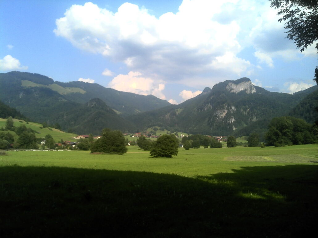
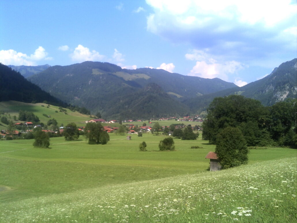
Wir starten am Wanderparkplatz in Hinterwössen, wenden uns links und folgen der Beschilderung Glockenbichl Rundweg. Am Waldrand entlang geht es nach kurzer Zeit einen sanften Anstieg hinauf und am Wiesenrand entlang. Von hier hat man einen schönen Blick in das Hochtal von Oberwössen. Wir folgen dem Weg über eine Brücke zurück nach Hinterwössen und gehen am Schlierbach zurück zum Ausgangspunkt. Der Blick vom Glockenbichl in das Hochtal von Oberwössen wird Sie begeistern.


 https://www.achental.com/storage/2024/09/74094_chiemhauser_alm.jpg
683
1024
admin
https://www.achental.com/storage/2022/07/achental-logo-weiss-horizontal-RGB@2x.png
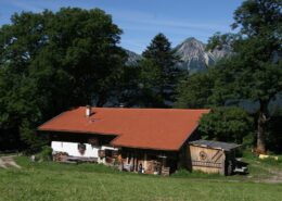
admin2026-06-10 15:20:042026-06-24 05:55:12Chiemhauser Alm
https://www.achental.com/storage/2024/09/74094_chiemhauser_alm.jpg
683
1024
admin
https://www.achental.com/storage/2022/07/achental-logo-weiss-horizontal-RGB@2x.png
admin2026-06-10 15:20:042026-06-24 05:55:12Chiemhauser Alm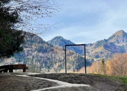 https://www.achental.com/storage/2026/06/DcHtGxyUvWs9nqkakIGPSBPtCfgD3LOi35aMnv1y.jpg
1920
1080
admin
https://www.achental.com/storage/2022/07/achental-logo-weiss-horizontal-RGB@2x.png
admin2026-06-02 05:01:012026-06-24 06:26:01Rundwanderung zur Bäcker Alm über Huttschen Steig und Streichenkirche
https://www.achental.com/storage/2026/06/DcHtGxyUvWs9nqkakIGPSBPtCfgD3LOi35aMnv1y.jpg
1920
1080
admin
https://www.achental.com/storage/2022/07/achental-logo-weiss-horizontal-RGB@2x.png
admin2026-06-02 05:01:012026-06-24 06:26:01Rundwanderung zur Bäcker Alm über Huttschen Steig und Streichenkirche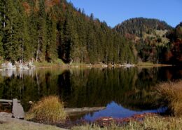 https://www.achental.com/storage/2024/08/26zYufdX4NMxLFSUAZU6qgctpZzeNaWddb48hxEO.jpg
1200
1600
admin
https://www.achental.com/storage/2022/07/achental-logo-weiss-horizontal-RGB@2x.png
admin2026-06-01 04:30:422026-06-24 05:31:01Schleching – Taubensee – Kössen
https://www.achental.com/storage/2024/08/26zYufdX4NMxLFSUAZU6qgctpZzeNaWddb48hxEO.jpg
1200
1600
admin
https://www.achental.com/storage/2022/07/achental-logo-weiss-horizontal-RGB@2x.png
admin2026-06-01 04:30:422026-06-24 05:31:01Schleching – Taubensee – Kössen https://www.achental.com/storage/2024/08/pejbmfCCGu4pWhIVHdwYPqxcr3MNRGeXG0ybNtIc.jpeg
1920
1440
admin
https://www.achental.com/storage/2022/07/achental-logo-weiss-horizontal-RGB@2x.png
admin2026-04-01 04:30:512026-06-24 05:34:45Großer Moorrundweg
https://www.achental.com/storage/2024/08/pejbmfCCGu4pWhIVHdwYPqxcr3MNRGeXG0ybNtIc.jpeg
1920
1440
admin
https://www.achental.com/storage/2022/07/achental-logo-weiss-horizontal-RGB@2x.png
admin2026-04-01 04:30:512026-06-24 05:34:45Großer Moorrundweg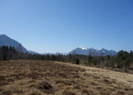 https://www.achental.com/storage/2024/08/55274_blick_in_die_berge_2_pl-scaled.jpg
1280
1920
admin
https://www.achental.com/storage/2022/07/achental-logo-weiss-horizontal-RGB@2x.png
admin2026-04-01 04:30:492026-06-24 05:31:21Kleiner Moorrundweg
https://www.achental.com/storage/2024/08/55274_blick_in_die_berge_2_pl-scaled.jpg
1280
1920
admin
https://www.achental.com/storage/2022/07/achental-logo-weiss-horizontal-RGB@2x.png
admin2026-04-01 04:30:492026-06-24 05:31:21Kleiner Moorrundweg https://www.achental.com/storage/2024/09/WZJlqIkVEuccA8p1fsOjMJSb0cxuH9tFgfrD2FDq.jpg
160
240
admin
https://www.achental.com/storage/2022/07/achental-logo-weiss-horizontal-RGB@2x.png
admin2026-03-12 04:31:002026-06-24 05:35:22Geigelsteinparkplatz – Breitenstein übers Karl – Walchsee
https://www.achental.com/storage/2024/09/WZJlqIkVEuccA8p1fsOjMJSb0cxuH9tFgfrD2FDq.jpg
160
240
admin
https://www.achental.com/storage/2022/07/achental-logo-weiss-horizontal-RGB@2x.png
admin2026-03-12 04:31:002026-06-24 05:35:22Geigelsteinparkplatz – Breitenstein übers Karl – Walchsee https://www.achental.com/storage/2024/12/LcejznXvo6xVyvNvxNL6JugyMICDsfQNecdq6Ovs-scaled.jpg
1440
1920
admin
https://www.achental.com/storage/2022/07/achental-logo-weiss-horizontal-RGB@2x.png
admin2026-01-27 04:30:302026-06-24 06:20:33Schlechinger Krippen-, Kirchen- und Kapellenweg
https://www.achental.com/storage/2024/12/LcejznXvo6xVyvNvxNL6JugyMICDsfQNecdq6Ovs-scaled.jpg
1440
1920
admin
https://www.achental.com/storage/2022/07/achental-logo-weiss-horizontal-RGB@2x.png
admin2026-01-27 04:30:302026-06-24 06:20:33Schlechinger Krippen-, Kirchen- und Kapellenweg https://www.achental.com/storage/2024/08/89715_IMG_6554.jpg
667
1000
admin
https://www.achental.com/storage/2022/07/achental-logo-weiss-horizontal-RGB@2x.png
admin2025-09-23 10:17:352026-06-24 05:57:24SalzAlpenSteig – Brachtalm – Bergen
https://www.achental.com/storage/2024/08/89715_IMG_6554.jpg
667
1000
admin
https://www.achental.com/storage/2022/07/achental-logo-weiss-horizontal-RGB@2x.png
admin2025-09-23 10:17:352026-06-24 05:57:24SalzAlpenSteig – Brachtalm – Bergen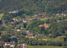 https://www.achental.com/storage/2024/08/b8iOrMdXDH2iRRzzzlFDQdO3WAtoGzvqAQKML4ax-scaled.jpg
1280
1920
admin
https://www.achental.com/storage/2022/07/achental-logo-weiss-horizontal-RGB@2x.png
admin2025-08-21 01:03:332026-06-24 05:38:14Kaiserblick
https://www.achental.com/storage/2024/08/b8iOrMdXDH2iRRzzzlFDQdO3WAtoGzvqAQKML4ax-scaled.jpg
1280
1920
admin
https://www.achental.com/storage/2022/07/achental-logo-weiss-horizontal-RGB@2x.png
admin2025-08-21 01:03:332026-06-24 05:38:14Kaiserblick https://www.achental.com/storage/2024/08/U3BrAJ0PL6ElYOY3ZdIlTL2rEqwwCGWqgHu9PJ5x-scaled.jpg
1280
1920
admin
https://www.achental.com/storage/2022/07/achental-logo-weiss-horizontal-RGB@2x.png
admin2025-08-21 01:03:332026-06-24 06:05:43Kaiserblick über Hofkapelle und Süssen
https://www.achental.com/storage/2024/08/U3BrAJ0PL6ElYOY3ZdIlTL2rEqwwCGWqgHu9PJ5x-scaled.jpg
1280
1920
admin
https://www.achental.com/storage/2022/07/achental-logo-weiss-horizontal-RGB@2x.png
admin2025-08-21 01:03:332026-06-24 06:05:43Kaiserblick über Hofkapelle und Süssen https://www.achental.com/storage/2024/09/58286_Eselgruppe_Feldlahnalm-scaled.jpg
1440
1920
admin
https://www.achental.com/storage/2022/07/achental-logo-weiss-horizontal-RGB@2x.png
admin2025-08-11 01:05:512026-06-24 05:55:19Feldlahn-Alm Runde
https://www.achental.com/storage/2024/09/58286_Eselgruppe_Feldlahnalm-scaled.jpg
1440
1920
admin
https://www.achental.com/storage/2022/07/achental-logo-weiss-horizontal-RGB@2x.png
admin2025-08-11 01:05:512026-06-24 05:55:19Feldlahn-Alm Runde https://www.achental.com/storage/2024/08/uAXwsoY3UYI9OGZhtcYSGQcm8ZSeNVffconHhfsx.jpg
1000
1500
admin
https://www.achental.com/storage/2022/07/achental-logo-weiss-horizontal-RGB@2x.png
admin2025-06-30 01:04:062026-06-24 05:31:39Kneipp-Rundweg
https://www.achental.com/storage/2024/08/uAXwsoY3UYI9OGZhtcYSGQcm8ZSeNVffconHhfsx.jpg
1000
1500
admin
https://www.achental.com/storage/2022/07/achental-logo-weiss-horizontal-RGB@2x.png
admin2025-06-30 01:04:062026-06-24 05:31:39Kneipp-Rundweg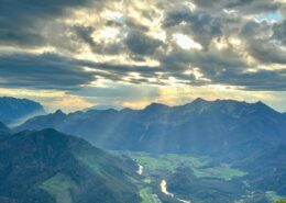 https://www.achental.com/storage/2025/04/nV476nrT9mvyHOa7MYY0bXVDdvYmGLPytpHjhkD5.jpg
1600
1200
admin
https://www.achental.com/storage/2022/07/achental-logo-weiss-horizontal-RGB@2x.png
admin2025-06-03 13:34:432026-06-24 06:21:22Wanderbus Tour – Von Unterwössen über Agersgschwendt-Alm, das Hochgernhaus und die Staudacher-Alm nach Staudach-Egerndach
https://www.achental.com/storage/2025/04/nV476nrT9mvyHOa7MYY0bXVDdvYmGLPytpHjhkD5.jpg
1600
1200
admin
https://www.achental.com/storage/2022/07/achental-logo-weiss-horizontal-RGB@2x.png
admin2025-06-03 13:34:432026-06-24 06:21:22Wanderbus Tour – Von Unterwössen über Agersgschwendt-Alm, das Hochgernhaus und die Staudacher-Alm nach Staudach-Egerndach https://www.achental.com/storage/2024/08/u2HwesK0YOAlwekbh9PZO1vtmYPpcOnerulf3hgO-scaled.jpg
1280
1920
admin
https://www.achental.com/storage/2022/07/achental-logo-weiss-horizontal-RGB@2x.png
admin2025-04-30 09:22:232026-06-24 06:21:17Wanderbus Tour – Von Schleching-Mühlau über Oberauerbrunstalm und Staffn-Alm zur Talstation Hochplattenbahn
https://www.achental.com/storage/2024/08/u2HwesK0YOAlwekbh9PZO1vtmYPpcOnerulf3hgO-scaled.jpg
1280
1920
admin
https://www.achental.com/storage/2022/07/achental-logo-weiss-horizontal-RGB@2x.png
admin2025-04-30 09:22:232026-06-24 06:21:17Wanderbus Tour – Von Schleching-Mühlau über Oberauerbrunstalm und Staffn-Alm zur Talstation Hochplattenbahn https://www.achental.com/storage/2024/08/51253_DSC00673_1920x1278.jpg
1278
1920
admin
https://www.achental.com/storage/2022/07/achental-logo-weiss-horizontal-RGB@2x.png
admin2025-04-30 09:21:342026-06-24 05:50:09Rundweg über die Grassauer Almen
https://www.achental.com/storage/2024/08/51253_DSC00673_1920x1278.jpg
1278
1920
admin
https://www.achental.com/storage/2022/07/achental-logo-weiss-horizontal-RGB@2x.png
admin2025-04-30 09:21:342026-06-24 05:50:09Rundweg über die Grassauer Almen https://www.achental.com/storage/2025/04/qpvmmdv49hl3yLq7YUmePgDvGu0440jyq5EF14aZ.jpg
1280
1920
admin
https://www.achental.com/storage/2022/07/achental-logo-weiss-horizontal-RGB@2x.png
admin2025-04-24 05:00:212026-06-24 06:21:30Wanderbus Tour – Von Hinterwössen über die Chiemhauser- und Baumgartner Alm zum Streichen Parkplatz
https://www.achental.com/storage/2025/04/qpvmmdv49hl3yLq7YUmePgDvGu0440jyq5EF14aZ.jpg
1280
1920
admin
https://www.achental.com/storage/2022/07/achental-logo-weiss-horizontal-RGB@2x.png
admin2025-04-24 05:00:212026-06-24 06:21:30Wanderbus Tour – Von Hinterwössen über die Chiemhauser- und Baumgartner Alm zum Streichen Parkplatz https://www.achental.com/storage/2025/04/R2NrdsxP0KrRNncszj3UXFYtJNaRR5Yf3VJs6eOi.jpg
1920
1080
admin
https://www.achental.com/storage/2022/07/achental-logo-weiss-horizontal-RGB@2x.png
admin2025-04-24 05:00:212026-06-24 06:21:35Wanderbus Tour – Schmugglerweg von Ortsmitte Schleching nach Kössen
https://www.achental.com/storage/2025/04/R2NrdsxP0KrRNncszj3UXFYtJNaRR5Yf3VJs6eOi.jpg
1920
1080
admin
https://www.achental.com/storage/2022/07/achental-logo-weiss-horizontal-RGB@2x.png
admin2025-04-24 05:00:212026-06-24 06:21:35Wanderbus Tour – Schmugglerweg von Ortsmitte Schleching nach Kössen https://www.achental.com/storage/2024/08/OqqtL2ddEOAljbylKsbGYuTNgwTs5VV03aCmQVk7-scaled.jpg
1280
1920
admin
https://www.achental.com/storage/2022/07/achental-logo-weiss-horizontal-RGB@2x.png
admin2025-04-24 01:08:072026-06-24 05:43:39Schmugglerweg nach Kössen
https://www.achental.com/storage/2024/08/OqqtL2ddEOAljbylKsbGYuTNgwTs5VV03aCmQVk7-scaled.jpg
1280
1920
admin
https://www.achental.com/storage/2022/07/achental-logo-weiss-horizontal-RGB@2x.png
admin2025-04-24 01:08:072026-06-24 05:43:39Schmugglerweg nach Kössen https://www.achental.com/storage/2024/08/voxbVcO3bBVlUIbcl51YsBrlURtXzsHL3rVxdvQK-scaled.jpeg
1280
1920
admin
https://www.achental.com/storage/2022/07/achental-logo-weiss-horizontal-RGB@2x.png
admin2025-04-24 01:08:062026-06-24 05:30:49Schmugglerweg zum Klobenstein
https://www.achental.com/storage/2024/08/voxbVcO3bBVlUIbcl51YsBrlURtXzsHL3rVxdvQK-scaled.jpeg
1280
1920
admin
https://www.achental.com/storage/2022/07/achental-logo-weiss-horizontal-RGB@2x.png
admin2025-04-24 01:08:062026-06-24 05:30:49Schmugglerweg zum Klobenstein https://www.achental.com/storage/2024/09/Lrn4CxS94HXy7iBGpcFNy7lcmQl6tEROrrwqSjXd-scaled.jpg
1079
1920
admin
https://www.achental.com/storage/2022/07/achental-logo-weiss-horizontal-RGB@2x.png
admin2025-04-14 01:03:572026-06-24 05:55:07Auf historischen Pfaden
https://www.achental.com/storage/2024/09/Lrn4CxS94HXy7iBGpcFNy7lcmQl6tEROrrwqSjXd-scaled.jpg
1079
1920
admin
https://www.achental.com/storage/2022/07/achental-logo-weiss-horizontal-RGB@2x.png
admin2025-04-14 01:03:572026-06-24 05:55:07Auf historischen Pfaden

 Priener Hütte über Karkopf-Gipfel