


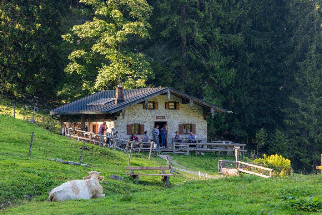
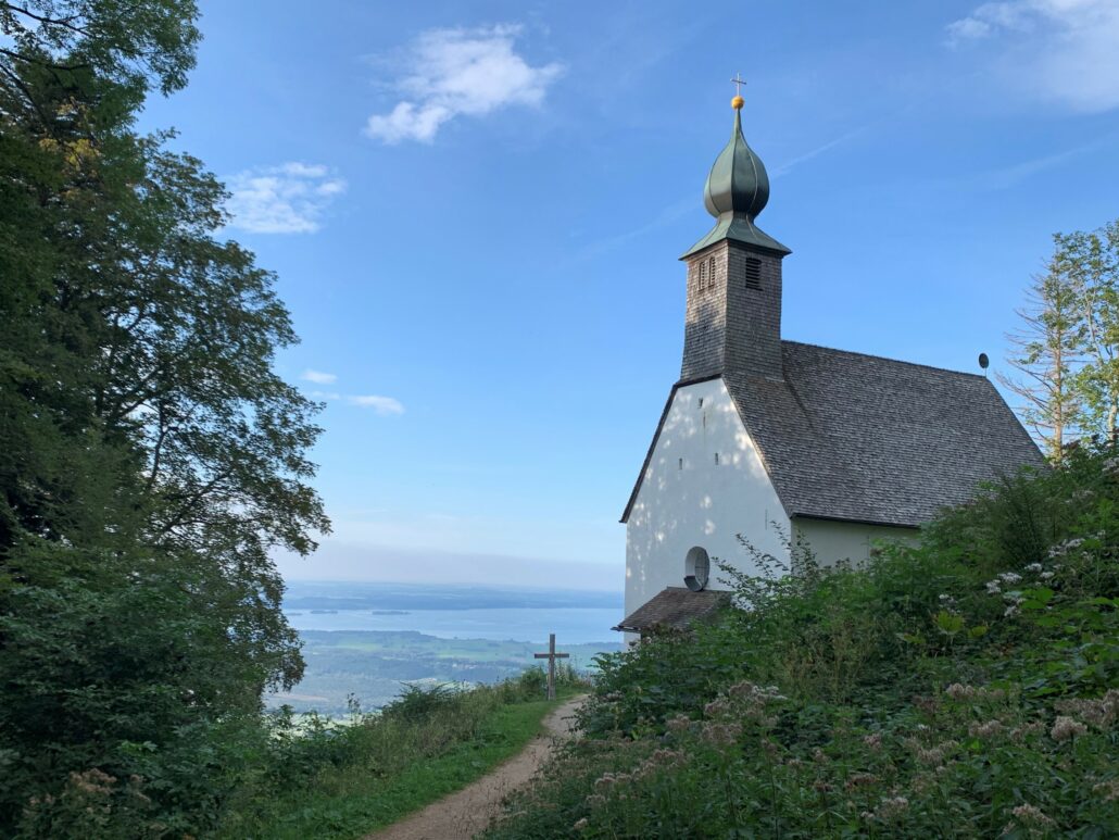
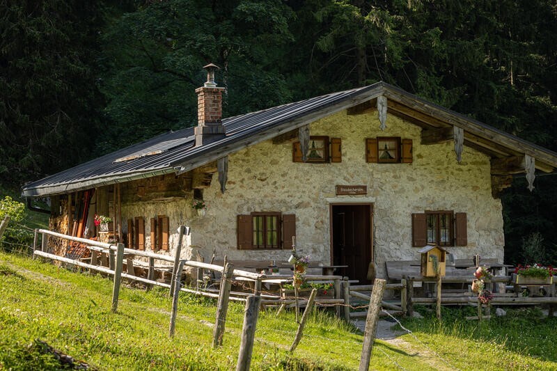
Staudacheralm – Schnappenkirche
Rundwanderung über Staudacheralm und Schnappenkirche

Distanz
Dauer
Höchster Punkt
Höhenmeter aufwärts
Höhenmeter abwärts
Wandern/Almwanderung
Einkehrmöglichkeiten: Staudacher Alm (*); (*) almtypische Brotzeiten, Kaffee und Kuchen während der Almweidezeit
Gastronomiebetriebe in Staudach-Egerndach:Gasthof Mühlwinkl, Gasthof Zum Ott (bitte individuelle Öffnungszeiten beachten)
Achental Wandernadel Kontrollstellen: Staudacher Alm, Schnappenkirche
Besonderheiten: Eine Tour, die Berge und den ChiemseeDer Chiemsee ist der größte See Bayerns und wird oft als „Bayerisches Meer“ bezeichnet. Er liegt im Chiemgau und ist ein beliebtes Ziel für Badegäste, Wassersportler und Ausflügler. vereint
Tipp: Zählt die Wasserfälle entlang des Alplbaches
Beschreibung: Vom Ortsende in Freiweidach folgen wir dem Schild in Richtung Mühlwinkl. Dort angekommen setzen wir die Wanderung durch einen schönen Buchenwald fort und halten uns weiter in Richtung Staudacher Alm. An der Alm gehen wir in Richtung Schnappenkirche. Dort angekommen haben wir einen herrlichen Ausblick auf den Chiemsee und die umliegenden Ortschaften. Nun geht es abwärts in Richtung MarquartsteinMarquartstein ist ein Luftkurort im Achental und ein beliebter Ausgangspunkt für Wanderungen, Bergtouren und Naturerlebnisse.. Der leicht begehbare Forstwegbreiter Weg, oft für Fahrzeuge geeignet führt uns vorbei an so manchem mächtigen Findling, der sogenannten Kindlwand und dem Scherbenstein. Am Wanderparkplatz angekommen halten wir uns in Richtung Staudach-Egerndach und kehren zurück zum Ausgangspunkt unserer Wanderung.


 https://www.achental.com/storage/2024/08/pejbmfCCGu4pWhIVHdwYPqxcr3MNRGeXG0ybNtIc.jpeg
1920
1440
admin
https://www.achental.com/storage/2022/07/achental-logo-weiss-horizontal-RGB@2x.png
admin2026-04-01 04:30:512026-05-13 06:02:19Großer Moorrundweg
https://www.achental.com/storage/2024/08/pejbmfCCGu4pWhIVHdwYPqxcr3MNRGeXG0ybNtIc.jpeg
1920
1440
admin
https://www.achental.com/storage/2022/07/achental-logo-weiss-horizontal-RGB@2x.png
admin2026-04-01 04:30:512026-05-13 06:02:19Großer Moorrundweg https://www.achental.com/storage/2024/08/55274_blick_in_die_berge_2_pl-scaled.jpg
1280
1920
admin
https://www.achental.com/storage/2022/07/achental-logo-weiss-horizontal-RGB@2x.png
admin2026-04-01 04:30:492026-05-13 05:52:00Kleiner Moorrundweg
https://www.achental.com/storage/2024/08/55274_blick_in_die_berge_2_pl-scaled.jpg
1280
1920
admin
https://www.achental.com/storage/2022/07/achental-logo-weiss-horizontal-RGB@2x.png
admin2026-04-01 04:30:492026-05-13 05:52:00Kleiner Moorrundweg https://www.achental.com/storage/2024/09/WZJlqIkVEuccA8p1fsOjMJSb0cxuH9tFgfrD2FDq.jpg
160
240
admin
https://www.achental.com/storage/2022/07/achental-logo-weiss-horizontal-RGB@2x.png
admin2026-03-12 04:31:002026-05-13 06:03:29Geigelsteinparkplatz – Breitenstein übers Karl – Walchsee
https://www.achental.com/storage/2024/09/WZJlqIkVEuccA8p1fsOjMJSb0cxuH9tFgfrD2FDq.jpg
160
240
admin
https://www.achental.com/storage/2022/07/achental-logo-weiss-horizontal-RGB@2x.png
admin2026-03-12 04:31:002026-05-13 06:03:29Geigelsteinparkplatz – Breitenstein übers Karl – Walchsee https://www.achental.com/storage/2024/12/LcejznXvo6xVyvNvxNL6JugyMICDsfQNecdq6Ovs-scaled.jpg
1440
1920
admin
https://www.achental.com/storage/2022/07/achental-logo-weiss-horizontal-RGB@2x.png
admin2026-01-27 04:30:302026-05-13 06:26:44Schlechinger Krippen-, Kirchen- und Kapellenweg
https://www.achental.com/storage/2024/12/LcejznXvo6xVyvNvxNL6JugyMICDsfQNecdq6Ovs-scaled.jpg
1440
1920
admin
https://www.achental.com/storage/2022/07/achental-logo-weiss-horizontal-RGB@2x.png
admin2026-01-27 04:30:302026-05-13 06:26:44Schlechinger Krippen-, Kirchen- und Kapellenweg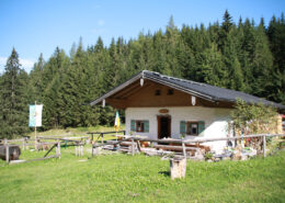 https://www.achental.com/storage/2024/08/89715_IMG_6554.jpg
667
1000
admin
https://www.achental.com/storage/2022/07/achental-logo-weiss-horizontal-RGB@2x.png
admin2025-09-23 10:17:352026-05-13 05:50:22SalzAlpenSteig – Brachtalm – Bergen
https://www.achental.com/storage/2024/08/89715_IMG_6554.jpg
667
1000
admin
https://www.achental.com/storage/2022/07/achental-logo-weiss-horizontal-RGB@2x.png
admin2025-09-23 10:17:352026-05-13 05:50:22SalzAlpenSteig – Brachtalm – Bergen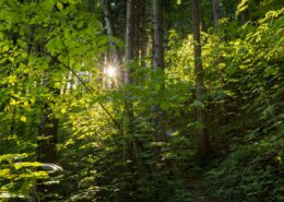 https://www.achental.com/storage/2024/08/U3BrAJ0PL6ElYOY3ZdIlTL2rEqwwCGWqgHu9PJ5x-scaled.jpg
1280
1920
admin
https://www.achental.com/storage/2022/07/achental-logo-weiss-horizontal-RGB@2x.png
admin2025-08-21 01:03:332026-05-13 06:15:26Kaiserblick über Hofkapelle und Süssen
https://www.achental.com/storage/2024/08/U3BrAJ0PL6ElYOY3ZdIlTL2rEqwwCGWqgHu9PJ5x-scaled.jpg
1280
1920
admin
https://www.achental.com/storage/2022/07/achental-logo-weiss-horizontal-RGB@2x.png
admin2025-08-21 01:03:332026-05-13 06:15:26Kaiserblick über Hofkapelle und Süssen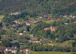 https://www.achental.com/storage/2024/08/b8iOrMdXDH2iRRzzzlFDQdO3WAtoGzvqAQKML4ax-scaled.jpg
1280
1920
admin
https://www.achental.com/storage/2022/07/achental-logo-weiss-horizontal-RGB@2x.png
admin2025-08-21 01:03:332026-05-13 05:44:00Kaiserblick
https://www.achental.com/storage/2024/08/b8iOrMdXDH2iRRzzzlFDQdO3WAtoGzvqAQKML4ax-scaled.jpg
1280
1920
admin
https://www.achental.com/storage/2022/07/achental-logo-weiss-horizontal-RGB@2x.png
admin2025-08-21 01:03:332026-05-13 05:44:00Kaiserblick https://www.achental.com/storage/2024/09/58286_Eselgruppe_Feldlahnalm-scaled.jpg
1440
1920
admin
https://www.achental.com/storage/2022/07/achental-logo-weiss-horizontal-RGB@2x.png
admin2025-08-11 01:05:512026-05-13 05:35:21Feldlahn-Alm Runde
https://www.achental.com/storage/2024/09/58286_Eselgruppe_Feldlahnalm-scaled.jpg
1440
1920
admin
https://www.achental.com/storage/2022/07/achental-logo-weiss-horizontal-RGB@2x.png
admin2025-08-11 01:05:512026-05-13 05:35:21Feldlahn-Alm Runde https://www.achental.com/storage/2024/08/uAXwsoY3UYI9OGZhtcYSGQcm8ZSeNVffconHhfsx.jpg
1000
1500
admin
https://www.achental.com/storage/2022/07/achental-logo-weiss-horizontal-RGB@2x.png
admin2025-06-30 01:04:062026-05-13 05:35:28Kneipp-Rundweg
https://www.achental.com/storage/2024/08/uAXwsoY3UYI9OGZhtcYSGQcm8ZSeNVffconHhfsx.jpg
1000
1500
admin
https://www.achental.com/storage/2022/07/achental-logo-weiss-horizontal-RGB@2x.png
admin2025-06-30 01:04:062026-05-13 05:35:28Kneipp-Rundweg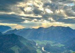 https://www.achental.com/storage/2025/04/nV476nrT9mvyHOa7MYY0bXVDdvYmGLPytpHjhkD5.jpg
1600
1200
admin
https://www.achental.com/storage/2022/07/achental-logo-weiss-horizontal-RGB@2x.png
admin2025-06-03 13:34:432026-05-13 06:27:26Wanderbus Tour – Von Unterwössen über Agersgschwendt-Alm, das Hochgernhaus und die Staudacher-Alm nach Staudach-Egerndach
https://www.achental.com/storage/2025/04/nV476nrT9mvyHOa7MYY0bXVDdvYmGLPytpHjhkD5.jpg
1600
1200
admin
https://www.achental.com/storage/2022/07/achental-logo-weiss-horizontal-RGB@2x.png
admin2025-06-03 13:34:432026-05-13 06:27:26Wanderbus Tour – Von Unterwössen über Agersgschwendt-Alm, das Hochgernhaus und die Staudacher-Alm nach Staudach-Egerndach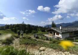 https://www.achental.com/storage/2024/08/u2HwesK0YOAlwekbh9PZO1vtmYPpcOnerulf3hgO-scaled.jpg
1280
1920
admin
https://www.achental.com/storage/2022/07/achental-logo-weiss-horizontal-RGB@2x.png
admin2025-04-30 09:22:232026-05-13 06:27:18Wanderbus Tour – Von Schleching-Mühlau über Oberauerbrunstalm und Staffn-Alm zur Talstation Hochplattenbahn
https://www.achental.com/storage/2024/08/u2HwesK0YOAlwekbh9PZO1vtmYPpcOnerulf3hgO-scaled.jpg
1280
1920
admin
https://www.achental.com/storage/2022/07/achental-logo-weiss-horizontal-RGB@2x.png
admin2025-04-30 09:22:232026-05-13 06:27:18Wanderbus Tour – Von Schleching-Mühlau über Oberauerbrunstalm und Staffn-Alm zur Talstation Hochplattenbahn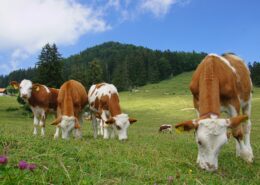 https://www.achental.com/storage/2024/08/51253_DSC00673_1920x1278.jpg
1278
1920
admin
https://www.achental.com/storage/2022/07/achental-logo-weiss-horizontal-RGB@2x.png
admin2025-04-30 09:21:342026-05-13 05:55:27Rundweg über die Grassauer Almen
https://www.achental.com/storage/2024/08/51253_DSC00673_1920x1278.jpg
1278
1920
admin
https://www.achental.com/storage/2022/07/achental-logo-weiss-horizontal-RGB@2x.png
admin2025-04-30 09:21:342026-05-13 05:55:27Rundweg über die Grassauer Almen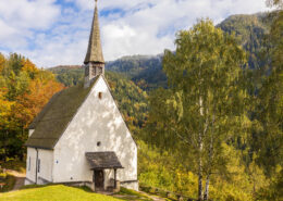 https://www.achental.com/storage/2025/04/qpvmmdv49hl3yLq7YUmePgDvGu0440jyq5EF14aZ.jpg
1280
1920
admin
https://www.achental.com/storage/2022/07/achental-logo-weiss-horizontal-RGB@2x.png
admin2025-04-24 05:00:212026-05-13 06:27:33Wanderbus Tour – Von Hinterwössen über die Chiemhauser- und Baumgartner Alm zum Streichen Parkplatz
https://www.achental.com/storage/2025/04/qpvmmdv49hl3yLq7YUmePgDvGu0440jyq5EF14aZ.jpg
1280
1920
admin
https://www.achental.com/storage/2022/07/achental-logo-weiss-horizontal-RGB@2x.png
admin2025-04-24 05:00:212026-05-13 06:27:33Wanderbus Tour – Von Hinterwössen über die Chiemhauser- und Baumgartner Alm zum Streichen Parkplatz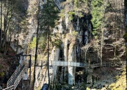 https://www.achental.com/storage/2025/04/R2NrdsxP0KrRNncszj3UXFYtJNaRR5Yf3VJs6eOi.jpg
1920
1080
admin
https://www.achental.com/storage/2022/07/achental-logo-weiss-horizontal-RGB@2x.png
admin2025-04-24 05:00:212026-05-13 06:27:44Wanderbus Tour – Schmugglerweg von Ortsmitte Schleching nach Kössen
https://www.achental.com/storage/2025/04/R2NrdsxP0KrRNncszj3UXFYtJNaRR5Yf3VJs6eOi.jpg
1920
1080
admin
https://www.achental.com/storage/2022/07/achental-logo-weiss-horizontal-RGB@2x.png
admin2025-04-24 05:00:212026-05-13 06:27:44Wanderbus Tour – Schmugglerweg von Ortsmitte Schleching nach Kössen https://www.achental.com/storage/2024/08/OqqtL2ddEOAljbylKsbGYuTNgwTs5VV03aCmQVk7-scaled.jpg
1280
1920
admin
https://www.achental.com/storage/2022/07/achental-logo-weiss-horizontal-RGB@2x.png
admin2025-04-24 01:08:072026-05-13 05:51:50Schmugglerweg nach Kössen
https://www.achental.com/storage/2024/08/OqqtL2ddEOAljbylKsbGYuTNgwTs5VV03aCmQVk7-scaled.jpg
1280
1920
admin
https://www.achental.com/storage/2022/07/achental-logo-weiss-horizontal-RGB@2x.png
admin2025-04-24 01:08:072026-05-13 05:51:50Schmugglerweg nach Kössen https://www.achental.com/storage/2024/08/voxbVcO3bBVlUIbcl51YsBrlURtXzsHL3rVxdvQK-scaled.jpeg
1280
1920
admin
https://www.achental.com/storage/2022/07/achental-logo-weiss-horizontal-RGB@2x.png
admin2025-04-24 01:08:062026-05-13 05:59:20Schmugglerweg zum Klobenstein
https://www.achental.com/storage/2024/08/voxbVcO3bBVlUIbcl51YsBrlURtXzsHL3rVxdvQK-scaled.jpeg
1280
1920
admin
https://www.achental.com/storage/2022/07/achental-logo-weiss-horizontal-RGB@2x.png
admin2025-04-24 01:08:062026-05-13 05:59:20Schmugglerweg zum Klobenstein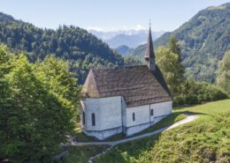 https://www.achental.com/storage/2024/09/Lrn4CxS94HXy7iBGpcFNy7lcmQl6tEROrrwqSjXd-scaled.jpg
1079
1920
admin
https://www.achental.com/storage/2022/07/achental-logo-weiss-horizontal-RGB@2x.png
admin2025-04-14 01:03:572026-05-13 05:42:14Auf historischen Pfaden
https://www.achental.com/storage/2024/09/Lrn4CxS94HXy7iBGpcFNy7lcmQl6tEROrrwqSjXd-scaled.jpg
1079
1920
admin
https://www.achental.com/storage/2022/07/achental-logo-weiss-horizontal-RGB@2x.png
admin2025-04-14 01:03:572026-05-13 05:42:14Auf historischen Pfaden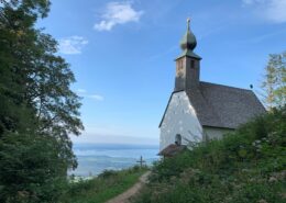 https://www.achental.com/storage/2024/08/XTVye7NysyLsUyQjmvcD4tVfHVyToA2BLZGzElsg-scaled.jpg
1440
1920
admin
https://www.achental.com/storage/2022/07/achental-logo-weiss-horizontal-RGB@2x.png
admin2025-04-09 01:11:092026-05-13 06:03:53Wanderbus Tour – Rundweg von Staudach-Egerndach über die Schnappenkirche zur Staudacher-Alm und zurück.
https://www.achental.com/storage/2024/08/XTVye7NysyLsUyQjmvcD4tVfHVyToA2BLZGzElsg-scaled.jpg
1440
1920
admin
https://www.achental.com/storage/2022/07/achental-logo-weiss-horizontal-RGB@2x.png
admin2025-04-09 01:11:092026-05-13 06:06:16Staudacheralm – Schnappenkirche
https://www.achental.com/storage/2024/08/XTVye7NysyLsUyQjmvcD4tVfHVyToA2BLZGzElsg-scaled.jpg
1440
1920
admin
https://www.achental.com/storage/2022/07/achental-logo-weiss-horizontal-RGB@2x.png
admin2025-04-09 01:11:092026-05-13 06:03:53Wanderbus Tour – Rundweg von Staudach-Egerndach über die Schnappenkirche zur Staudacher-Alm und zurück.
https://www.achental.com/storage/2024/08/XTVye7NysyLsUyQjmvcD4tVfHVyToA2BLZGzElsg-scaled.jpg
1440
1920
admin
https://www.achental.com/storage/2022/07/achental-logo-weiss-horizontal-RGB@2x.png
admin2025-04-09 01:11:092026-05-13 06:06:16Staudacheralm – Schnappenkirche https://www.achental.com/storage/2024/08/SigVHP5a1CNN8m82o60CrmXEMIjKx75KZSbwl60J-scaled.jpg
1280
1920
admin
https://www.achental.com/storage/2022/07/achental-logo-weiss-horizontal-RGB@2x.png
admin2025-02-24 01:06:162026-05-13 05:35:03Großer Tal-Rundweg
https://www.achental.com/storage/2024/08/SigVHP5a1CNN8m82o60CrmXEMIjKx75KZSbwl60J-scaled.jpg
1280
1920
admin
https://www.achental.com/storage/2022/07/achental-logo-weiss-horizontal-RGB@2x.png
admin2025-02-24 01:06:162026-05-13 05:35:03Großer Tal-Rundweg

 Auf historischen Pfaden
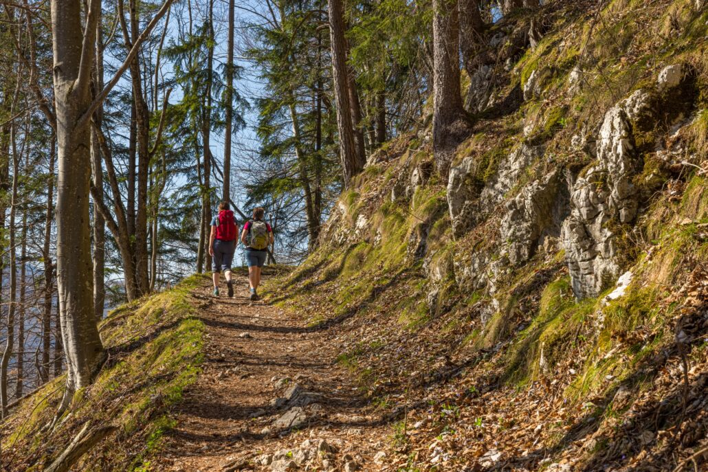