


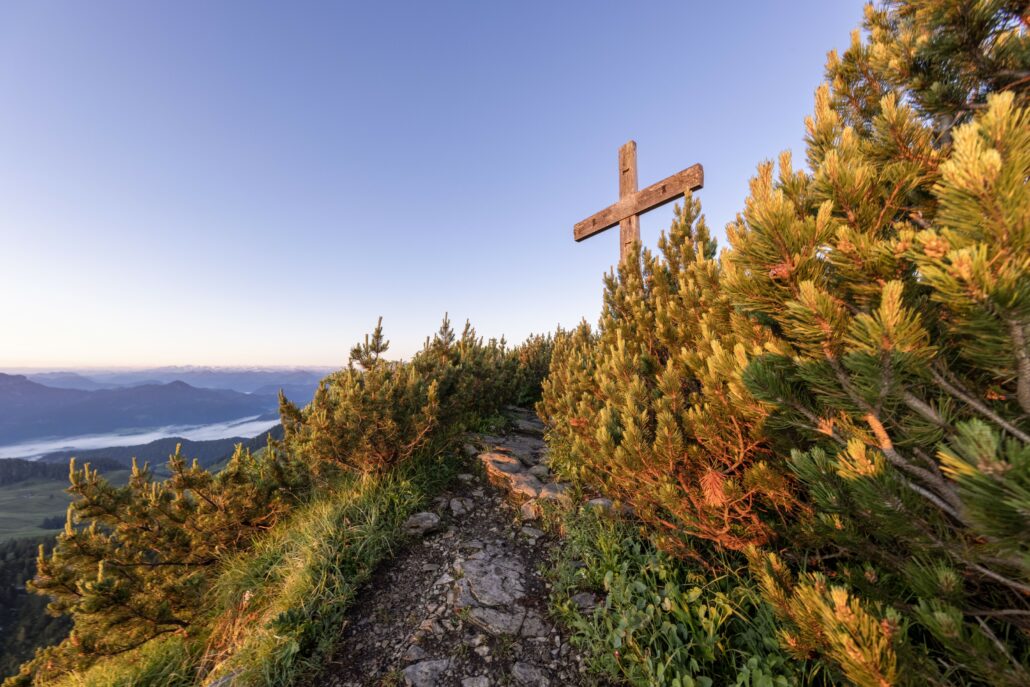
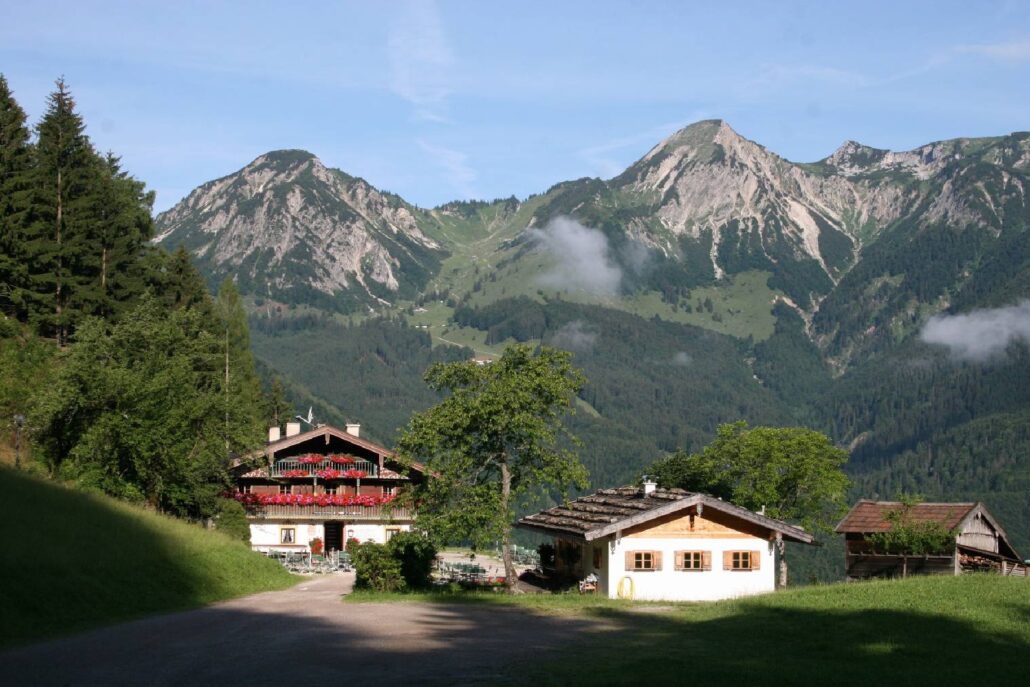
Breitenstein – Gipfelwanderung
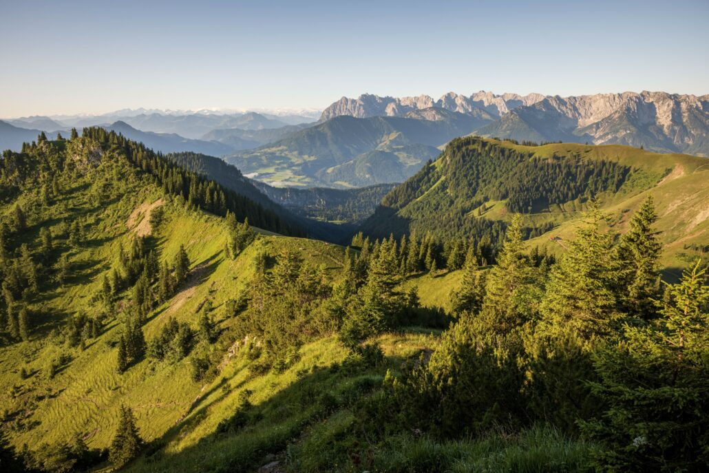
Gipfelrundwanderung mit Flora- und Fauna-Highlights im Naturschutzgebiet Geigelstein und wunderbarem Bergpanorama

Distanz
Dauer
Höchster Punkt
Höhenmeter aufwärts
Höhenmeter abwärts
Gipfelwanderung
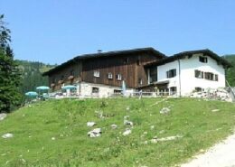
Schlechinger Gastronomiebetriebe: Landgasthof zur Post, Gasthof Geigelstein ‘Beim Hopfei’, Pizzeria Raggio di Sole, Dorfladen SchlechingSchleching ist eine Gemeinde im Achental und bekannt für ihre ursprüngliche Natur, traditionelle Bauweise und ruhige Lage., nah und gut Bachmann, Alpenhotel dahoam (Frühstück mit Voranmeldung auch für externe Gäste möglich), Café Bonbon & Keksi, Gasthof Zellerwand ‘Beim Birner’, Rait’ner Wirt
Achental Wandernadel Kontrollstellen: Wuhrsteinalm, Karl
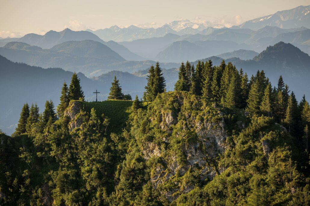
Besonderheiten: Almgebiet der Karlalm, ein Paradies für die dort lebenden Murmeltiere; Gämsen am Breitensteinmassiv
Beschreibung: Vom Parkplatz Geigelstein in Ettenhausen führt ein Forstwegbreiter Weg, oft für Fahrzeuge geeignet Richtung Rudersburg. Nach der Brücke rechts in den Steigschmaler Wanderpfad Richtung Grießelberg (Gamsweg). Über das Karl mit der verfallenen Karlalm und dem Karl Joch erreichen wir den Breitenstein Gipfel. Retour geht es über das Käferl Schneid zur Wirtsalm und dem Wuhrstein-Gebiet. Über den Forstweg erreichen wir schließlich unseren Ausgangspunkt, den Parkplatz Geigelstein.


 https://www.achental.com/storage/2024/08/V85qzoFtwvrn5VZsDfeEgGXRoARz7CkQSVEqbcXP.jpg
276
414
admin
https://www.achental.com/storage/2022/07/achental-logo-weiss-horizontal-RGB@2x.png
admin2026-04-28 15:26:102026-06-19 05:37:15Geigelsteinparkplatz – Priener Hütte – Karkopf – Walchsee
https://www.achental.com/storage/2024/08/V85qzoFtwvrn5VZsDfeEgGXRoARz7CkQSVEqbcXP.jpg
276
414
admin
https://www.achental.com/storage/2022/07/achental-logo-weiss-horizontal-RGB@2x.png
admin2026-04-28 15:26:102026-06-19 05:37:15Geigelsteinparkplatz – Priener Hütte – Karkopf – Walchsee https://www.achental.com/storage/2024/09/57445_Wuhrstein-Alm.jpg
680
1024
admin
https://www.achental.com/storage/2022/07/achental-logo-weiss-horizontal-RGB@2x.png
admin2026-04-28 15:25:032026-06-19 05:36:20Breitenstein-Gipfel nach Sachrang
https://www.achental.com/storage/2024/09/57445_Wuhrstein-Alm.jpg
680
1024
admin
https://www.achental.com/storage/2022/07/achental-logo-weiss-horizontal-RGB@2x.png
admin2026-04-28 15:25:032026-06-19 05:36:20Breitenstein-Gipfel nach Sachrang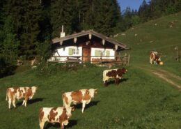 https://www.achental.com/storage/2026/04/mDplbSUeXMNaRxZNExovaC0jsOysn1jpcZsvK2s2.jpeg
588
919
admin
https://www.achental.com/storage/2022/07/achental-logo-weiss-horizontal-RGB@2x.png
admin2026-04-21 04:30:482026-06-19 05:36:29Mühlau über Dalsenalm Weitlahnerkopf zum Geigelsteinparkplatz
https://www.achental.com/storage/2026/04/mDplbSUeXMNaRxZNExovaC0jsOysn1jpcZsvK2s2.jpeg
588
919
admin
https://www.achental.com/storage/2022/07/achental-logo-weiss-horizontal-RGB@2x.png
admin2026-04-21 04:30:482026-06-19 05:36:29Mühlau über Dalsenalm Weitlahnerkopf zum Geigelsteinparkplatz https://www.achental.com/storage/2024/09/i2PTHGv3Ot2A33wLBP5gFo78fQfBY9uNPg6eKbOh-scaled.jpg
1280
1920
admin
https://www.achental.com/storage/2022/07/achental-logo-weiss-horizontal-RGB@2x.png
admin2026-03-12 04:30:592026-06-19 05:41:14Breitenstein – Gipfelwanderung
https://www.achental.com/storage/2024/09/i2PTHGv3Ot2A33wLBP5gFo78fQfBY9uNPg6eKbOh-scaled.jpg
1280
1920
admin
https://www.achental.com/storage/2022/07/achental-logo-weiss-horizontal-RGB@2x.png
admin2026-03-12 04:30:592026-06-19 05:41:14Breitenstein – Gipfelwanderung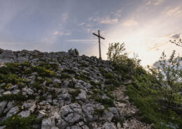 https://www.achental.com/storage/2024/11/kumieFaFNy4TODg33aumxnb1IIKaLCATNmC2aBgn-scaled.jpg
1281
1920
admin
https://www.achental.com/storage/2022/07/achental-logo-weiss-horizontal-RGB@2x.png
admin2026-03-12 04:30:582026-06-19 06:24:03Kleine Schlechinger Reibn
https://www.achental.com/storage/2024/11/kumieFaFNy4TODg33aumxnb1IIKaLCATNmC2aBgn-scaled.jpg
1281
1920
admin
https://www.achental.com/storage/2022/07/achental-logo-weiss-horizontal-RGB@2x.png
admin2026-03-12 04:30:582026-06-19 06:24:03Kleine Schlechinger Reibn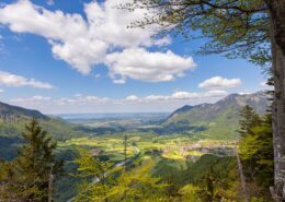 https://www.achental.com/storage/2024/08/KRxCdIj4WAspwy6f5LsEbx0Xj4GlO4ttQkcsWkbm-scaled.jpg
1280
1920
admin
https://www.achental.com/storage/2022/07/achental-logo-weiss-horizontal-RGB@2x.png
admin2026-01-27 04:30:322026-06-19 05:53:08Gscheuerwand von Schleching
https://www.achental.com/storage/2024/08/KRxCdIj4WAspwy6f5LsEbx0Xj4GlO4ttQkcsWkbm-scaled.jpg
1280
1920
admin
https://www.achental.com/storage/2022/07/achental-logo-weiss-horizontal-RGB@2x.png
admin2026-01-27 04:30:322026-06-19 05:53:08Gscheuerwand von Schleching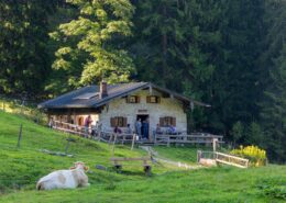 https://www.achental.com/storage/2024/08/jNumiLedGbmjrXUGpwtTzX1E5FtayRN6Fp0v173Z-scaled.jpg
1280
1920
admin
https://www.achental.com/storage/2022/07/achental-logo-weiss-horizontal-RGB@2x.png
admin2025-04-30 09:22:492026-06-19 05:40:58Zum Hochgerngipfel von Staudach-Egerndach und zurück
https://www.achental.com/storage/2024/08/jNumiLedGbmjrXUGpwtTzX1E5FtayRN6Fp0v173Z-scaled.jpg
1280
1920
admin
https://www.achental.com/storage/2022/07/achental-logo-weiss-horizontal-RGB@2x.png
admin2025-04-30 09:22:492026-06-19 05:40:58Zum Hochgerngipfel von Staudach-Egerndach und zurück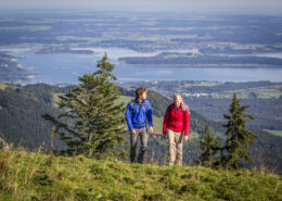 https://www.achental.com/storage/2024/08/51254__MG_4468-scaled.jpg
1280
1920
admin
https://www.achental.com/storage/2022/07/achental-logo-weiss-horizontal-RGB@2x.png
admin2025-04-30 09:21:002026-06-19 05:40:03Gipfelwanderung zur Hochplatte
https://www.achental.com/storage/2024/08/51254__MG_4468-scaled.jpg
1280
1920
admin
https://www.achental.com/storage/2022/07/achental-logo-weiss-horizontal-RGB@2x.png
admin2025-04-30 09:21:002026-06-19 05:40:03Gipfelwanderung zur Hochplatte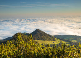 https://www.achental.com/storage/2024/08/pNOYU41w89nc6an8cQmtaiHtWXng9bwdLmji4G6I-scaled.jpg
1280
1920
admin
https://www.achental.com/storage/2022/07/achental-logo-weiss-horizontal-RGB@2x.png
admin2025-04-29 10:30:252026-06-19 05:41:19Hochplatte-Gipfelwanderung
https://www.achental.com/storage/2024/08/pNOYU41w89nc6an8cQmtaiHtWXng9bwdLmji4G6I-scaled.jpg
1280
1920
admin
https://www.achental.com/storage/2022/07/achental-logo-weiss-horizontal-RGB@2x.png
admin2025-04-29 10:30:252026-06-19 05:41:19Hochplatte-Gipfelwanderung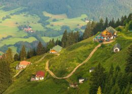 https://www.achental.com/storage/2024/08/Q972k6Fel5ZEr90cXOqgLhDTb4Bac98OBpoLIGVs-scaled.jpg
1080
1920
admin
https://www.achental.com/storage/2022/07/achental-logo-weiss-horizontal-RGB@2x.png
admin2025-03-25 10:43:022026-06-19 06:09:26Hochgern über Agersgschwendt und Hochgernhaus
https://www.achental.com/storage/2024/08/Q972k6Fel5ZEr90cXOqgLhDTb4Bac98OBpoLIGVs-scaled.jpg
1080
1920
admin
https://www.achental.com/storage/2022/07/achental-logo-weiss-horizontal-RGB@2x.png
admin2025-03-25 10:43:022026-06-19 06:09:26Hochgern über Agersgschwendt und Hochgernhaus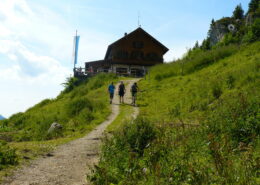 https://www.achental.com/storage/2024/08/51255_Das_Hochgernhaus-scaled.jpg
1440
1920
admin
https://www.achental.com/storage/2022/07/achental-logo-weiss-horizontal-RGB@2x.png
admin2024-12-20 01:05:482026-06-19 05:40:10Hochgern von Marquartstein
https://www.achental.com/storage/2024/08/51255_Das_Hochgernhaus-scaled.jpg
1440
1920
admin
https://www.achental.com/storage/2022/07/achental-logo-weiss-horizontal-RGB@2x.png
admin2024-12-20 01:05:482026-06-19 05:40:10Hochgern von Marquartstein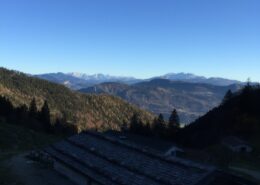 https://www.achental.com/storage/2024/08/kbn6pMPNBhstBDWENQL5OPSO1neOPQuAvqAitNaS-scaled.jpg
1920
1440
admin
https://www.achental.com/storage/2022/07/achental-logo-weiss-horizontal-RGB@2x.png
admin2024-12-20 01:05:482026-06-19 05:33:28Kampenwand-Gipfelwanderung
https://www.achental.com/storage/2024/08/kbn6pMPNBhstBDWENQL5OPSO1neOPQuAvqAitNaS-scaled.jpg
1920
1440
admin
https://www.achental.com/storage/2022/07/achental-logo-weiss-horizontal-RGB@2x.png
admin2024-12-20 01:05:482026-06-19 05:33:28Kampenwand-Gipfelwanderung https://www.achental.com/storage/2024/08/89366_DASSU-scaled.jpg
1280
1920
admin
https://www.achental.com/storage/2022/07/achental-logo-weiss-horizontal-RGB@2x.png
admin2024-12-20 01:05:482026-06-19 05:57:41Gscheuerwand
https://www.achental.com/storage/2024/08/89366_DASSU-scaled.jpg
1280
1920
admin
https://www.achental.com/storage/2022/07/achental-logo-weiss-horizontal-RGB@2x.png
admin2024-12-20 01:05:482026-06-19 05:57:41Gscheuerwand https://www.achental.com/storage/2024/08/5HHs7EYAmCACoLdU7PyN6dbe6g19SucV3xuJBYwC-scaled.jpg
1280
1920
admin
https://www.achental.com/storage/2022/07/achental-logo-weiss-horizontal-RGB@2x.png
admin2024-12-20 01:05:402026-06-19 05:53:23Hochgern-Gipfel über Staudacheralm und Hochgernhaus
https://www.achental.com/storage/2024/08/5HHs7EYAmCACoLdU7PyN6dbe6g19SucV3xuJBYwC-scaled.jpg
1280
1920
admin
https://www.achental.com/storage/2022/07/achental-logo-weiss-horizontal-RGB@2x.png
admin2024-12-20 01:05:402026-06-19 05:53:23Hochgern-Gipfel über Staudacheralm und Hochgernhaus https://www.achental.com/storage/2024/08/2xyQLWuPmAQ8msSDnygQRqnnJKsqNtYBJwvj5znS-scaled.jpg
1280
1920
admin
https://www.achental.com/storage/2022/07/achental-logo-weiss-horizontal-RGB@2x.png
admin2024-12-20 01:05:372026-06-19 05:56:24Überquerung zum Hochfelln über Bischofsfelln-Alm
https://www.achental.com/storage/2024/08/2xyQLWuPmAQ8msSDnygQRqnnJKsqNtYBJwvj5znS-scaled.jpg
1280
1920
admin
https://www.achental.com/storage/2022/07/achental-logo-weiss-horizontal-RGB@2x.png
admin2024-12-20 01:05:372026-06-19 05:56:24Überquerung zum Hochfelln über Bischofsfelln-Alm https://www.achental.com/storage/2024/08/3F6Juajsy62U8fL6Fr7HjSz9KBf6mRWc6tnhtws6-scaled.jpg
1280
1920
admin
https://www.achental.com/storage/2022/07/achental-logo-weiss-horizontal-RGB@2x.png
admin2024-12-20 01:05:342026-06-19 05:45:43Hochgern über Schnappenkirche, Abstieg über Hochgernhaus
https://www.achental.com/storage/2024/08/3F6Juajsy62U8fL6Fr7HjSz9KBf6mRWc6tnhtws6-scaled.jpg
1280
1920
admin
https://www.achental.com/storage/2022/07/achental-logo-weiss-horizontal-RGB@2x.png
admin2024-12-20 01:05:342026-06-19 05:45:43Hochgern über Schnappenkirche, Abstieg über Hochgernhaus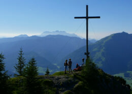 https://www.achental.com/storage/2024/09/57452_Rudersburg_2.jpg
1440
1920
admin
https://www.achental.com/storage/2022/07/achental-logo-weiss-horizontal-RGB@2x.png
admin2024-12-20 01:05:322026-06-19 05:37:08Geigelsteinparkplatz – Grießelberg – Rudersburg – Wetterfahne – Touristinfo Kössen
https://www.achental.com/storage/2024/09/57452_Rudersburg_2.jpg
1440
1920
admin
https://www.achental.com/storage/2022/07/achental-logo-weiss-horizontal-RGB@2x.png
admin2024-12-20 01:05:322026-06-19 05:37:08Geigelsteinparkplatz – Grießelberg – Rudersburg – Wetterfahne – Touristinfo Kössen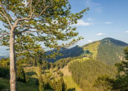 https://www.achental.com/storage/2024/08/yY9Los7PAHmDKLXKbT5xfwrsQOIKtOI1xQZOxrRT-scaled.jpg
1280
1920
admin
https://www.achental.com/storage/2022/07/achental-logo-weiss-horizontal-RGB@2x.png
admin2024-12-20 01:05:262026-06-19 05:52:33Überschreitung Hochplatte
https://www.achental.com/storage/2024/08/yY9Los7PAHmDKLXKbT5xfwrsQOIKtOI1xQZOxrRT-scaled.jpg
1280
1920
admin
https://www.achental.com/storage/2022/07/achental-logo-weiss-horizontal-RGB@2x.png
admin2024-12-20 01:05:262026-06-19 05:52:33Überschreitung Hochplatte

 Geigelsteinparkplatz – Breitenstein übers Karl – Walchsee
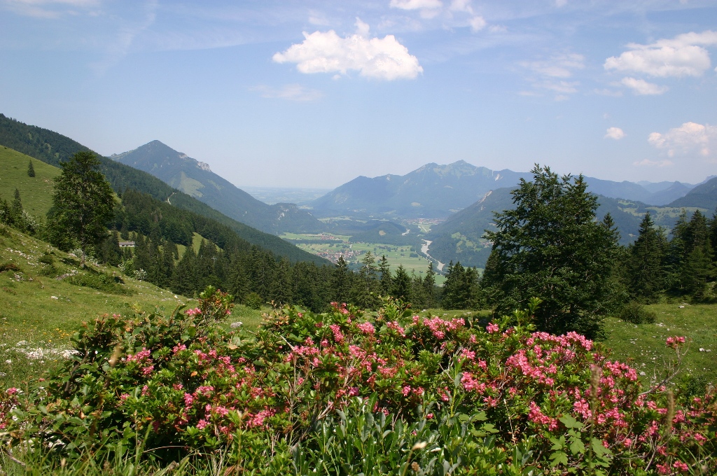