Hochgern-Gipfel über Staudacheralm und Hochgernhaus
Hochgern-Gipfel über Staudacheralm und Hochgernhaus (vom Wanderparkplatz Freiweidach) - den Hochgern von seiner markanten und wilden Nordseite kennenlernen

Hochgern-Gipfel über Staudacheralm und Hochgernhaus (vom Wanderparkplatz Freiweidach) - den Hochgern von seiner markanten und wilden Nordseite kennenlernen
Distanz
Dauer
Höchster Punkt
Höhenmeter aufwärts
Höhenmeter abwärts
Schwierigkeitsgrad
schwer
Gipfelwanderung
Einkehrmöglichkeit: Staudacher Alm (*), Hochgernhaus, Agersgschwendt-Alm (*); (*) almtypische Brotzeiten, Kaffee und Kuchen während der Almweidezeit (bitte Öffnungszeiten beachten)
Achental Wandernadel Kontrollstellen: Staudacher Alm, Hochgernhaus, Agersgschwendt-Alm
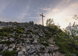
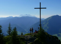
Besonderheiten: Malerische Hochgernkapelle am Gipfel, wunderbares Panorama auf den Chiemsee im Norden und auf das Achental und die Alpenkette auf der Südseite, Gleitschirmflieger-Startplatz in Gipfelnähe – hier können die Flugsportler beim Start in die Lüfte bestaunt werden
Beschreibung: Vom Ortsende in Freiweidach aus folgen wir dem Schild in Richtung Staudacher Alm. Angekommen in Staudach setzen wir die Wanderung durch einen schönen Buchenwald fort und halten uns weiter in Richtung Staudacher Alm. An der Alm gehen wir vorbei in Richtung Hochgern. Der Weg führt uns über einen schweißtreibenden Steilanstieg in Kehren auf den Hochgernsattel und dann nach links zum Gipfel. Vom Gipfel aus überblicken wir den Chiemsee und das gesamte Chiemgau. Zum Ausgangspunkt zurück benutzen wir jedoch eine andere Route über das Hochgernhaus, dann abwärts über die Agersgschwendt-Alm und wir erreichen den Wanderparkplatz. Wir halten wir uns nun in Richtung Staudach-Egerndach und kehren zurück zum Ausgangspunkt unserer Wanderung.
Einkehrmöglichkeit
Wanderparkplatz Freiweidach
 https://www.achental.com/storage/2024/08/jNumiLedGbmjrXUGpwtTzX1E5FtayRN6Fp0v173Z-scaled.jpg
1280
1920
admin
https://www.achental.com/storage/2022/07/achental-logo-weiss-horizontal-RGB@2x.png
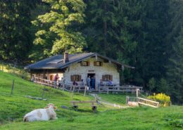
admin2025-04-30 09:22:492025-07-12 06:25:58Zum Hochgerngipfel von Staudach-Egerndach und zurück
 https://www.achental.com/storage/2024/08/51254__MG_4468-scaled.jpg
1280
1920
admin
https://www.achental.com/storage/2022/07/achental-logo-weiss-horizontal-RGB@2x.png
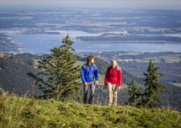
admin2025-04-30 09:21:002025-07-12 05:41:44Gipfelwanderung zur Hochplatte
 https://www.achental.com/storage/2024/08/pNOYU41w89nc6an8cQmtaiHtWXng9bwdLmji4G6I-scaled.jpg
1280
1920
admin
https://www.achental.com/storage/2022/07/achental-logo-weiss-horizontal-RGB@2x.png
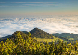
admin2025-04-29 10:30:252025-07-12 05:45:50Hochplatte-Gipfelwanderung
 https://www.achental.com/storage/2024/08/Q972k6Fel5ZEr90cXOqgLhDTb4Bac98OBpoLIGVs-scaled.jpg
1080
1920
admin
https://www.achental.com/storage/2022/07/achental-logo-weiss-horizontal-RGB@2x.png
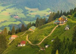
admin2025-03-25 10:43:022025-07-12 05:45:03Hochgern über Agersgschwendt und Hochgernhaus
 https://www.achental.com/storage/2024/08/V85qzoFtwvrn5VZsDfeEgGXRoARz7CkQSVEqbcXP.jpg
276
414
admin
https://www.achental.com/storage/2022/07/achental-logo-weiss-horizontal-RGB@2x.png
admin2025-01-29 13:27:182025-07-12 05:41:37Geigelsteinparkplatz – Priener Hütte – Karkopf – Walchsee
 https://www.achental.com/storage/2024/08/89366_DASSU-scaled.jpg
1280
1920
admin
https://www.achental.com/storage/2022/07/achental-logo-weiss-horizontal-RGB@2x.png
admin2024-12-20 01:05:482025-07-12 05:44:36Gscheuerwand
 https://www.achental.com/storage/2024/08/51255_Das_Hochgernhaus-scaled.jpg
1440
1920
admin
https://www.achental.com/storage/2022/07/achental-logo-weiss-horizontal-RGB@2x.png
admin2024-12-20 01:05:482025-07-12 05:45:28Hochgern von Marquartstein
 https://www.achental.com/storage/2024/08/kbn6pMPNBhstBDWENQL5OPSO1neOPQuAvqAitNaS-scaled.jpg
1920
1440
admin
https://www.achental.com/storage/2022/07/achental-logo-weiss-horizontal-RGB@2x.png
admin2024-12-20 01:05:482025-07-12 05:48:50Kampenwand-Gipfelwanderung
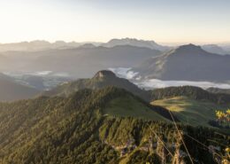 https://www.achental.com/storage/2024/08/4WMxIBKCyuWSSCvgBCJ0EOfXCDL3joJK7YbGBEaY-scaled.jpg
1280
1920
admin
https://www.achental.com/storage/2022/07/achental-logo-weiss-horizontal-RGB@2x.png
admin2024-12-20 01:05:442025-07-12 06:01:21Rudersburg – Gipfelwanderung
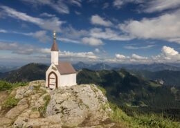 https://www.achental.com/storage/2024/08/5HHs7EYAmCACoLdU7PyN6dbe6g19SucV3xuJBYwC-scaled.jpg
1280
1920
admin
https://www.achental.com/storage/2022/07/achental-logo-weiss-horizontal-RGB@2x.png
admin2024-12-20 01:05:402025-07-12 05:45:37Hochgern-Gipfel über Staudacheralm und Hochgernhaus
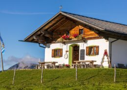 https://www.achental.com/storage/2024/08/PDXTIYRlSO2NR0tbH5V47XiOqAXpyv18Xg7OUusx-scaled.jpg
1280
1920
admin
https://www.achental.com/storage/2022/07/achental-logo-weiss-horizontal-RGB@2x.png
admin2024-12-20 01:05:372025-07-12 05:48:41Kampenwand über Piesenhausener Hochalm
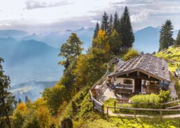 https://www.achental.com/storage/2024/08/2xyQLWuPmAQ8msSDnygQRqnnJKsqNtYBJwvj5znS-scaled.jpg
1280
1920
admin
https://www.achental.com/storage/2022/07/achental-logo-weiss-horizontal-RGB@2x.png
admin2024-12-20 01:05:372025-07-12 06:17:14Überquerung zum Hochfelln über Bischofsfelln-Alm
 https://www.achental.com/storage/2024/11/kumieFaFNy4TODg33aumxnb1IIKaLCATNmC2aBgn-scaled.jpg
1281
1920
admin
https://www.achental.com/storage/2022/07/achental-logo-weiss-horizontal-RGB@2x.png
admin2024-12-20 01:05:352025-07-12 05:48:59Kleine Schlechinger Reibn
 https://www.achental.com/storage/2024/08/3F6Juajsy62U8fL6Fr7HjSz9KBf6mRWc6tnhtws6-scaled.jpg
1280
1920
admin
https://www.achental.com/storage/2022/07/achental-logo-weiss-horizontal-RGB@2x.png
admin2024-12-20 01:05:342025-07-12 05:45:20Hochgern über Schnappenkirche, Abstieg über Hochgernhaus
 https://www.achental.com/storage/2024/09/57452_Rudersburg_2.jpg
1440
1920
admin
https://www.achental.com/storage/2022/07/achental-logo-weiss-horizontal-RGB@2x.png
admin2024-12-20 01:05:322025-07-12 05:41:31Geigelsteinparkplatz – Grießelberg – Rudersburg – Wetterfahne – Touristinfo Kössen
 https://www.achental.com/storage/2024/09/i2PTHGv3Ot2A33wLBP5gFo78fQfBY9uNPg6eKbOh-scaled.jpg
1280
1920
admin
https://www.achental.com/storage/2022/07/achental-logo-weiss-horizontal-RGB@2x.png
admin2024-12-20 01:05:322025-07-12 05:37:11Breitenstein – Gipfelwanderung
 https://www.achental.com/storage/2024/09/57445_Wuhrstein-Alm.jpg
680
1024
admin
https://www.achental.com/storage/2022/07/achental-logo-weiss-horizontal-RGB@2x.png
admin2024-12-20 01:05:312025-07-12 05:37:19Breitenstein-Gipfel nach Sachrang
 https://www.achental.com/storage/2024/08/EV0gv5rRN4dJnKhAg7EIYZJLruTUOCato7s5xHvR-scaled.jpg
1280
1920
admin
https://www.achental.com/storage/2022/07/achental-logo-weiss-horizontal-RGB@2x.png
admin2024-12-20 01:05:312025-07-12 06:24:19Weitlahnerkopf
 https://www.achental.com/storage/2024/08/yY9Los7PAHmDKLXKbT5xfwrsQOIKtOI1xQZOxrRT-scaled.jpg
1280
1920
admin
https://www.achental.com/storage/2022/07/achental-logo-weiss-horizontal-RGB@2x.png
admin2024-12-20 01:05:262025-07-12 06:17:23Überschreitung Hochplatte
 https://www.achental.com/storage/2024/08/KRxCdIj4WAspwy6f5LsEbx0Xj4GlO4ttQkcsWkbm-scaled.jpg
1280
1920
admin
https://www.achental.com/storage/2022/07/achental-logo-weiss-horizontal-RGB@2x.png
admin2024-12-20 01:05:242025-07-12 05:44:43Gscheuerwand von Schleching

 Von Oberwössen über die Röthelmoos zum Weitsee
 Achental | Ferienregion Chiemsee-Chiemgau
Erklärung zur Barrierefreiheit
www.achental.com
12.07.2025
Konformitätsstatus
Wir sind der festen Überzeugung, dass das Internet für jeden verfügbar und zugänglich sein sollte, und setzen uns dafür ein, eine Website bereitzustellen, die für ein möglichst breites Publikum zugänglich ist, unabhängig von den Umständen und Fähigkeiten.
Um dies zu erreichen, versuchen wir, die Web Content Accessibility Guidelines 2.1 (WCAG 2.1) des World Wide Web Consortiums (W3C) auf AA-Ebene so genau wie möglich einzuhalten. Diese Richtlinien erklären, wie Webinhalte für Menschen mit einer Vielzahl von Behinderungen zugänglich gemacht werden können. Die Einhaltung dieser Richtlinien hilft uns sicherzustellen, dass die Website für alle Menschen zugänglich ist: Blinde, Menschen mit motorischen Beeinträchtigungen, Sehbehinderungen, kognitiven Behinderungen und mehr.
Diese Website nutzt verschiedene Technologien, die sie jederzeit so zugänglich wie möglich machen sollen. Wir nutzen eine Barrierefreiheitsschnittstelle, die es Personen mit bestimmten Behinderungen ermöglicht, die Benutzeroberfläche der Website anzupassen und sie an ihre persönlichen Bedürfnisse anzupassen.
Darüber hinaus nutzt die Website eine KI-basierte Anwendung, die im Hintergrund ausgeführt wird und ihren Barrierefreiheitsgrad ständig optimiert. Diese Anwendung korrigiert das HTML der Website und passt ihre Funktionalität und ihr Verhalten an Screenreader an, die von blinden Benutzern verwendet werden, sowie an Tastaturfunktionen, die von Personen mit motorischen Einschränkungen verwendet werden.
Wenn Sie eine Fehlfunktion festgestellt haben oder Verbesserungsvorschläge haben, freuen wir uns, von Ihnen zu hören. Sie können die Betreiber der Website unter der folgenden E-Mail-Adresse erreichen: info@achental.com
Screenreader und Tastaturnavigation
Unsere Website implementiert die ARIA-Attributtechnik (Accessible Rich Internet Applications) sowie verschiedene andere Verhaltensänderungen, um sicherzustellen, dass blinde Benutzer, die Screenreader verwenden, die Funktionen der Website lesen, verstehen und nutzen können. Sobald ein Benutzer mit einem Screenreader Ihre Website betritt, wird er sofort aufgefordert, das Screenreader-Profil einzugeben, damit er Ihre Website effektiv durchsuchen und bedienen kann. So erfüllt unsere Website einige der wichtigsten Screenreader-Anforderungen, zusammen mit Konsolen-Screenshots von Codebeispielen:
Screenreader-Optimierung: Wir führen einen Hintergrundprozess aus, der die Komponenten der Website von Grund auf lernt, um eine fortlaufende Konformität auch bei Aktualisierungen der Website sicherzustellen. In diesem Prozess stellen wir Screenreadern mithilfe des ARIA-Attributsatzes aussagekräftige Daten zur Verfügung. Wir stellen beispielsweise genaue Formularbeschriftungen bereit; Beschreibungen für aktionsfähige Symbole (Social-Media-Symbole, Suchsymbole, Einkaufswagensymbole usw.); Validierungsleitfäden für Formulareingaben; Elementrollen wie Schaltflächen, Menüs, modale Dialoge (Popups) und andere. Darüber hinaus scannt der Hintergrundprozess alle Bilder der Website und stellt eine genaue und aussagekräftige, auf Bildobjekterkennung basierende Beschreibung als ALT-Tag (alternativer Text) für Bilder bereit, die nicht beschrieben sind. Mithilfe einer OCR-Technologie (optische Zeichenerkennung) extrahiert er auch Texte, die in das Bild eingebettet sind. Um Screenreader-Anpassungen jederzeit zu aktivieren, müssen Benutzer nur die Tastenkombination Alt+1 drücken. Benutzer von Screenreadern erhalten außerdem automatische Hinweise, den Screenreader-Modus einzuschalten, sobald sie die Website aufrufen.
Diese Anpassungen sind mit allen gängigen Screenreadern kompatibel, einschließlich JAWS und NVDA.
Optimierung der Tastaturnavigation: Der Hintergrundprozess passt auch das HTML der Website an und fügt mithilfe von JavaScript-Code verschiedene Verhaltensweisen hinzu, um die Website mit der Tastatur bedienbar zu machen. Dazu gehört die Möglichkeit, mit den Tasten Tab und Umschalt+Tab auf der Website zu navigieren, Dropdowns mit den Pfeiltasten zu bedienen, sie mit Esc zu schließen, Schaltflächen und Links mit der Eingabetaste auszulösen, mit den Pfeiltasten zwischen Options- und Kontrollkästchenelementen zu navigieren und sie mit der Leertaste oder der Eingabetaste auszufüllen. Darüber hinaus finden Tastaturbenutzer Schnellnavigations- und Inhaltsüberspringmenüs, die jederzeit durch Klicken auf Alt+1 oder als erste Elemente der Site beim Navigieren mit der Tastatur verfügbar sind. Der Hintergrundprozess verarbeitet auch ausgelöste Popups, indem er den Tastaturfokus auf sie verschiebt, sobald sie erscheinen, und nicht zulässt, dass der Fokus darüber hinaus driftet.
Benutzer können auch Tastenkombinationen wie „M“ (Menüs), „H“ (Überschriften), „F“ (Formulare), „B“ (Schaltflächen) und „G“ (Grafiken) verwenden, um zu bestimmten Elementen zu springen.
Auf unserer Website unterstützte Behindertenprofile
Kompatibilität mit Browsern und Hilfstechnologien
Wir möchten die größtmögliche Bandbreite an Browsern und Hilfstechnologien unterstützen, damit unsere Benutzer die für sie am besten geeigneten Tools mit so wenig Einschränkungen wie möglich auswählen können. Daher haben wir sehr hart daran gearbeitet, alle wichtigen Systeme unterstützen zu können, die über 95 % des Benutzermarktanteils ausmachen, darunter Google Chrome, Mozilla Firefox, Apple Safari, Opera und Microsoft Edge, JAWS und NVDA (Bildschirmleseprogramme).
Anmerkungen, Kommentare und Feedback
Trotz unserer allergrößten Bemühungen, es jedem zu ermöglichen, die Website an seine Bedürfnisse anzupassen, kann es immer noch Seiten oder Abschnitte geben, die nicht vollständig zugänglich sind, sich im Prozess der Barrierefreiheit befinden oder für die eine angemessene technische Lösung fehlt, um sie zugänglich zu machen. Dennoch verbessern wir unsere Barrierefreiheit kontinuierlich, fügen Optionen und Funktionen hinzu, aktualisieren und verbessern sie und entwickeln und übernehmen neue Technologien. All dies soll dazu dienen, das optimale Maß an Barrierefreiheit zu erreichen, das dem technologischen Fortschritt folgt. Wenn Sie Hilfe benötigen, wenden Sie sich bitte an info@achental.com

