


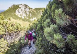
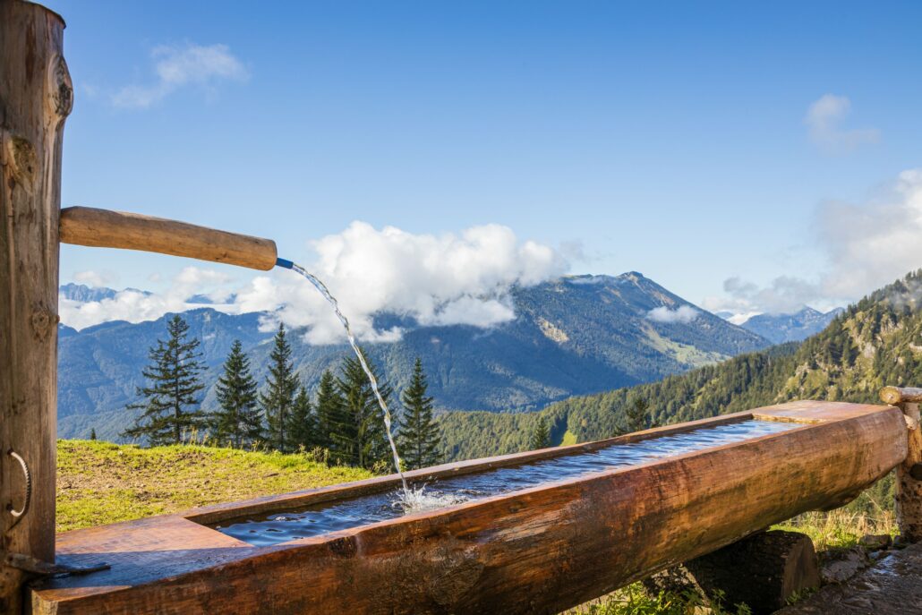
Überschreitung Hochplatte
Aussichtsreiche, ausgiebige Rundtour über den Hochplatten-Gipfel zur Talstation der Hochplattenbahn

Distanz
Dauer
Höchster Punkt
Höhenmeter aufwärts
Höhenmeter abwärts
Gipfelwanderung
Einkehrmöglichkeit: Berggasthof Staffn-Alm (bitte Öffnungszeiten beachten)
Achental Wandernadel Kontrollstellen: Staffn-Alm, Hochplatte
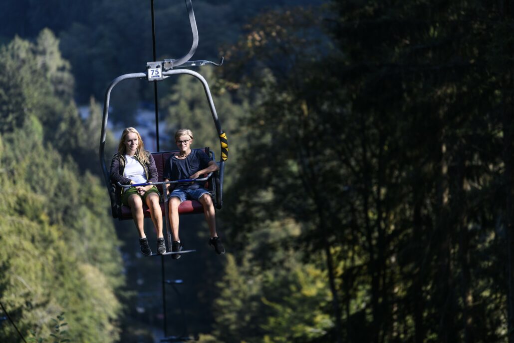
Tipp: Für die einfachere, verkürzte Version, fährt die HochplattenbahnDie Hochplattenbahn ist eine Seilbahn in Marquartstein, die Besucher bequem auf die Hochplatte bringt – einen beliebten Ausgangspunkt für Wanderungen und Ausblicke über den Chiemgau. bis zur Staffn-Alm hoch und wieder talabwärts
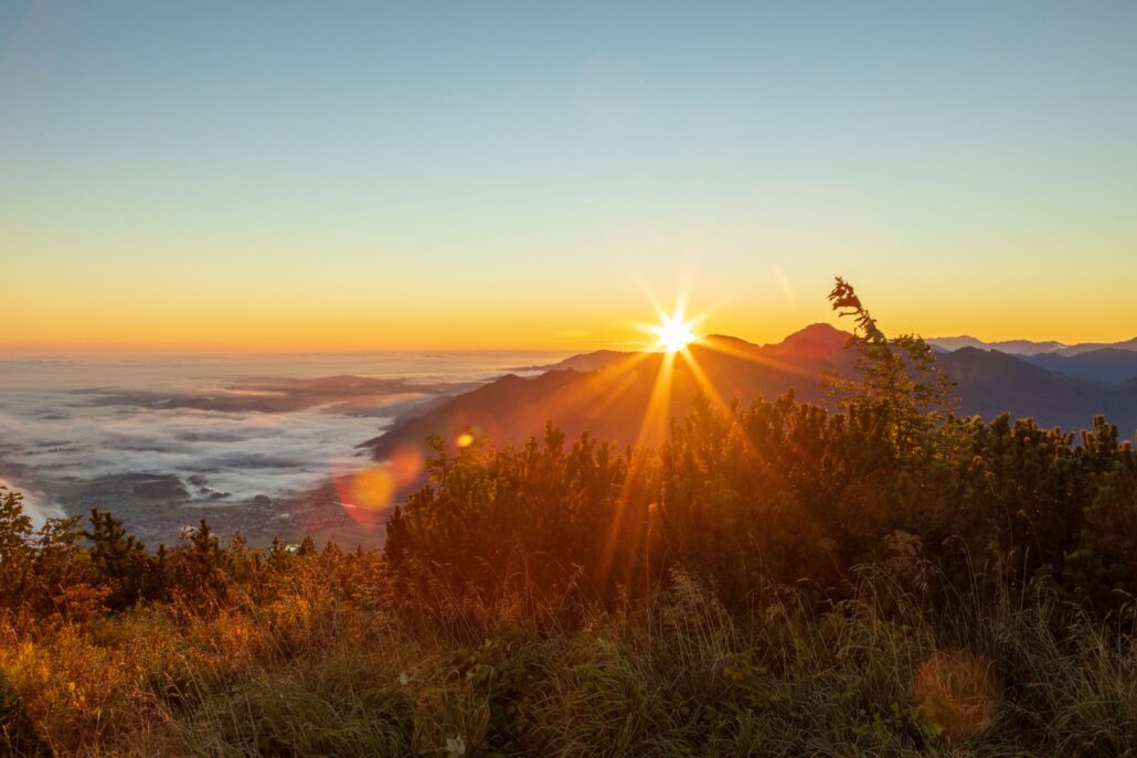
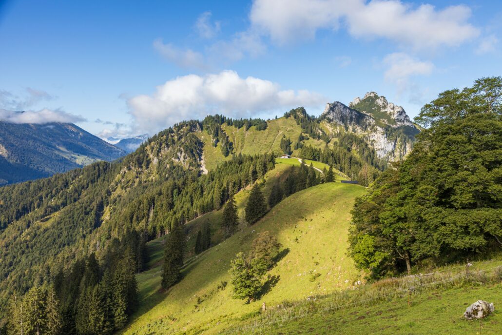
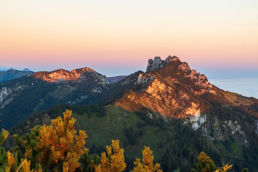
Beschreibung: Abwechslungsreiche Gipfeltour mit Aufstiegshilfe: Ab der Bergstation der Hochplattenbahn geht es zunächst über die Forststraße und später über den Plattensteig zum Gipfel der Hochplatte. Dort genießen wir eine Rundumsicht vom Chiemgauer Voralpenland mit dem ChiemseeDer Chiemsee ist der größte See Bayerns und wird oft als „Bayerisches Meer“ bezeichnet. Er liegt im Chiemgau und ist ein beliebtes Ziel für Badegäste, Wassersportler und Ausflügler. bis hinein ins benachbarte Tirol und bei schönem Wetter bis zum Alpenhauptkamm. Westlich liegt markant die Kampenwand. Abstieg nach Süden hinunter, vorbei am Teufelsstein in Richtung Oberauer Brunst. Am Abzweig nach links in Richtung Weitwiesalm. Ein kurzes Stück, nachdem der Steig in einen Forstweg übergeht, biegen wir erneut nach links zur Huberalm ab. Von dort weiter in Richtung MarquartsteinMarquartstein ist ein Luftkurort im Achental und ein beliebter Ausgangspunkt für Wanderungen, Bergtouren und Naturerlebnisse. und zum Aussichtspunkt Kaiserblick. Ab dort weiter auf Forststraße hinunter zur Talstation der Hochplattenbahn und damit zum Talort unseres Ausgangspunktes zurück.


 https://www.achental.com/storage/2024/10/rrM7MTjDwRPEK7Qg2dk8z2OPzNiC6gjQ1urjRhMz.jpg
800
1200
admin
https://www.achental.com/storage/2022/07/achental-logo-weiss-horizontal-RGB@2x.png
admin2026-07-07 04:30:582026-07-08 06:18:13Freundschaftsweg “Gipfel” Bergsteigerdörfer Schleching und Sachrang
https://www.achental.com/storage/2024/10/rrM7MTjDwRPEK7Qg2dk8z2OPzNiC6gjQ1urjRhMz.jpg
800
1200
admin
https://www.achental.com/storage/2022/07/achental-logo-weiss-horizontal-RGB@2x.png
admin2026-07-07 04:30:582026-07-08 06:18:13Freundschaftsweg “Gipfel” Bergsteigerdörfer Schleching und Sachrang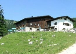 https://www.achental.com/storage/2024/08/V85qzoFtwvrn5VZsDfeEgGXRoARz7CkQSVEqbcXP.jpg
276
414
admin
https://www.achental.com/storage/2022/07/achental-logo-weiss-horizontal-RGB@2x.png
admin2026-04-28 15:26:102026-07-08 05:34:26Geigelsteinparkplatz – Priener Hütte – Karkopf – Walchsee
https://www.achental.com/storage/2024/08/V85qzoFtwvrn5VZsDfeEgGXRoARz7CkQSVEqbcXP.jpg
276
414
admin
https://www.achental.com/storage/2022/07/achental-logo-weiss-horizontal-RGB@2x.png
admin2026-04-28 15:26:102026-07-08 05:34:26Geigelsteinparkplatz – Priener Hütte – Karkopf – Walchsee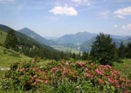 https://www.achental.com/storage/2024/09/57445_Wuhrstein-Alm.jpg
680
1024
admin
https://www.achental.com/storage/2022/07/achental-logo-weiss-horizontal-RGB@2x.png
admin2026-04-28 15:25:032026-07-08 05:31:49Breitenstein-Gipfel nach Sachrang
https://www.achental.com/storage/2024/09/57445_Wuhrstein-Alm.jpg
680
1024
admin
https://www.achental.com/storage/2022/07/achental-logo-weiss-horizontal-RGB@2x.png
admin2026-04-28 15:25:032026-07-08 05:31:49Breitenstein-Gipfel nach Sachrang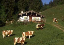 https://www.achental.com/storage/2026/04/mDplbSUeXMNaRxZNExovaC0jsOysn1jpcZsvK2s2.jpeg
588
919
admin
https://www.achental.com/storage/2022/07/achental-logo-weiss-horizontal-RGB@2x.png
admin2026-04-21 04:30:482026-07-08 05:31:57Mühlau über Dalsenalm Weitlahnerkopf zum Geigelsteinparkplatz
https://www.achental.com/storage/2026/04/mDplbSUeXMNaRxZNExovaC0jsOysn1jpcZsvK2s2.jpeg
588
919
admin
https://www.achental.com/storage/2022/07/achental-logo-weiss-horizontal-RGB@2x.png
admin2026-04-21 04:30:482026-07-08 05:31:57Mühlau über Dalsenalm Weitlahnerkopf zum Geigelsteinparkplatz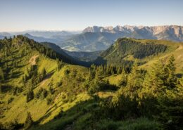 https://www.achental.com/storage/2024/09/i2PTHGv3Ot2A33wLBP5gFo78fQfBY9uNPg6eKbOh-scaled.jpg
1280
1920
admin
https://www.achental.com/storage/2022/07/achental-logo-weiss-horizontal-RGB@2x.png
admin2026-03-12 04:30:592026-07-08 05:35:54Breitenstein – Gipfelwanderung
https://www.achental.com/storage/2024/09/i2PTHGv3Ot2A33wLBP5gFo78fQfBY9uNPg6eKbOh-scaled.jpg
1280
1920
admin
https://www.achental.com/storage/2022/07/achental-logo-weiss-horizontal-RGB@2x.png
admin2026-03-12 04:30:592026-07-08 05:35:54Breitenstein – Gipfelwanderung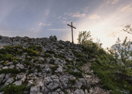 https://www.achental.com/storage/2024/11/kumieFaFNy4TODg33aumxnb1IIKaLCATNmC2aBgn-scaled.jpg
1281
1920
admin
https://www.achental.com/storage/2022/07/achental-logo-weiss-horizontal-RGB@2x.png
admin2026-03-12 04:30:582026-07-08 06:18:37Kleine Schlechinger Reibn
https://www.achental.com/storage/2024/11/kumieFaFNy4TODg33aumxnb1IIKaLCATNmC2aBgn-scaled.jpg
1281
1920
admin
https://www.achental.com/storage/2022/07/achental-logo-weiss-horizontal-RGB@2x.png
admin2026-03-12 04:30:582026-07-08 06:18:37Kleine Schlechinger Reibn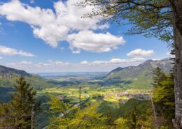 https://www.achental.com/storage/2024/08/KRxCdIj4WAspwy6f5LsEbx0Xj4GlO4ttQkcsWkbm-scaled.jpg
1280
1920
admin
https://www.achental.com/storage/2022/07/achental-logo-weiss-horizontal-RGB@2x.png
admin2026-01-27 04:30:322026-07-08 05:47:06Gscheuerwand von Schleching
https://www.achental.com/storage/2024/08/KRxCdIj4WAspwy6f5LsEbx0Xj4GlO4ttQkcsWkbm-scaled.jpg
1280
1920
admin
https://www.achental.com/storage/2022/07/achental-logo-weiss-horizontal-RGB@2x.png
admin2026-01-27 04:30:322026-07-08 05:47:06Gscheuerwand von Schleching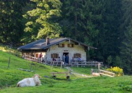 https://www.achental.com/storage/2024/08/jNumiLedGbmjrXUGpwtTzX1E5FtayRN6Fp0v173Z-scaled.jpg
1280
1920
admin
https://www.achental.com/storage/2022/07/achental-logo-weiss-horizontal-RGB@2x.png
admin2025-04-30 09:22:492026-07-08 05:35:41Zum Hochgerngipfel von Staudach-Egerndach und zurück
https://www.achental.com/storage/2024/08/jNumiLedGbmjrXUGpwtTzX1E5FtayRN6Fp0v173Z-scaled.jpg
1280
1920
admin
https://www.achental.com/storage/2022/07/achental-logo-weiss-horizontal-RGB@2x.png
admin2025-04-30 09:22:492026-07-08 05:35:41Zum Hochgerngipfel von Staudach-Egerndach und zurück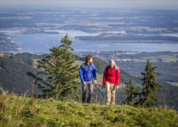 https://www.achental.com/storage/2024/08/51254__MG_4468-scaled.jpg
1280
1920
admin
https://www.achental.com/storage/2022/07/achental-logo-weiss-horizontal-RGB@2x.png
admin2025-04-30 09:21:002026-07-08 05:35:01Gipfelwanderung zur Hochplatte
https://www.achental.com/storage/2024/08/51254__MG_4468-scaled.jpg
1280
1920
admin
https://www.achental.com/storage/2022/07/achental-logo-weiss-horizontal-RGB@2x.png
admin2025-04-30 09:21:002026-07-08 05:35:01Gipfelwanderung zur Hochplatte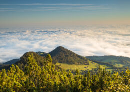 https://www.achental.com/storage/2024/08/pNOYU41w89nc6an8cQmtaiHtWXng9bwdLmji4G6I-scaled.jpg
1280
1920
admin
https://www.achental.com/storage/2022/07/achental-logo-weiss-horizontal-RGB@2x.png
admin2025-04-29 10:30:252026-07-08 05:35:59Hochplatte-Gipfelwanderung
https://www.achental.com/storage/2024/08/pNOYU41w89nc6an8cQmtaiHtWXng9bwdLmji4G6I-scaled.jpg
1280
1920
admin
https://www.achental.com/storage/2022/07/achental-logo-weiss-horizontal-RGB@2x.png
admin2025-04-29 10:30:252026-07-08 05:35:59Hochplatte-Gipfelwanderung https://www.achental.com/storage/2024/08/Q972k6Fel5ZEr90cXOqgLhDTb4Bac98OBpoLIGVs-scaled.jpg
1080
1920
admin
https://www.achental.com/storage/2022/07/achental-logo-weiss-horizontal-RGB@2x.png
admin2025-03-25 10:43:022026-07-08 06:03:43Hochgern über Agersgschwendt und Hochgernhaus
https://www.achental.com/storage/2024/08/Q972k6Fel5ZEr90cXOqgLhDTb4Bac98OBpoLIGVs-scaled.jpg
1080
1920
admin
https://www.achental.com/storage/2022/07/achental-logo-weiss-horizontal-RGB@2x.png
admin2025-03-25 10:43:022026-07-08 06:03:43Hochgern über Agersgschwendt und Hochgernhaus https://www.achental.com/storage/2024/08/kbn6pMPNBhstBDWENQL5OPSO1neOPQuAvqAitNaS-scaled.jpg
1920
1440
admin
https://www.achental.com/storage/2022/07/achental-logo-weiss-horizontal-RGB@2x.png
admin2024-12-20 01:05:482026-07-08 05:31:11Kampenwand-Gipfelwanderung
https://www.achental.com/storage/2024/08/kbn6pMPNBhstBDWENQL5OPSO1neOPQuAvqAitNaS-scaled.jpg
1920
1440
admin
https://www.achental.com/storage/2022/07/achental-logo-weiss-horizontal-RGB@2x.png
admin2024-12-20 01:05:482026-07-08 05:31:11Kampenwand-Gipfelwanderung https://www.achental.com/storage/2024/08/89366_DASSU-scaled.jpg
1280
1920
admin
https://www.achental.com/storage/2022/07/achental-logo-weiss-horizontal-RGB@2x.png
admin2024-12-20 01:05:482026-07-08 05:51:46Gscheuerwand
https://www.achental.com/storage/2024/08/89366_DASSU-scaled.jpg
1280
1920
admin
https://www.achental.com/storage/2022/07/achental-logo-weiss-horizontal-RGB@2x.png
admin2024-12-20 01:05:482026-07-08 05:51:46Gscheuerwand https://www.achental.com/storage/2024/08/51255_Das_Hochgernhaus-scaled.jpg
1440
1920
admin
https://www.achental.com/storage/2022/07/achental-logo-weiss-horizontal-RGB@2x.png
admin2024-12-20 01:05:482026-07-08 05:35:06Hochgern von Marquartstein
https://www.achental.com/storage/2024/08/51255_Das_Hochgernhaus-scaled.jpg
1440
1920
admin
https://www.achental.com/storage/2022/07/achental-logo-weiss-horizontal-RGB@2x.png
admin2024-12-20 01:05:482026-07-08 05:35:06Hochgern von Marquartstein https://www.achental.com/storage/2024/08/5HHs7EYAmCACoLdU7PyN6dbe6g19SucV3xuJBYwC-scaled.jpg
1280
1920
admin
https://www.achental.com/storage/2022/07/achental-logo-weiss-horizontal-RGB@2x.png
admin2024-12-20 01:05:402026-07-08 05:47:20Hochgern-Gipfel über Staudacheralm und Hochgernhaus
https://www.achental.com/storage/2024/08/5HHs7EYAmCACoLdU7PyN6dbe6g19SucV3xuJBYwC-scaled.jpg
1280
1920
admin
https://www.achental.com/storage/2022/07/achental-logo-weiss-horizontal-RGB@2x.png
admin2024-12-20 01:05:402026-07-08 05:47:20Hochgern-Gipfel über Staudacheralm und Hochgernhaus https://www.achental.com/storage/2024/08/2xyQLWuPmAQ8msSDnygQRqnnJKsqNtYBJwvj5znS-scaled.jpg
1280
1920
admin
https://www.achental.com/storage/2022/07/achental-logo-weiss-horizontal-RGB@2x.png
admin2024-12-20 01:05:372026-07-08 05:50:21Überquerung zum Hochfelln über Bischofsfelln-Alm
https://www.achental.com/storage/2024/08/2xyQLWuPmAQ8msSDnygQRqnnJKsqNtYBJwvj5znS-scaled.jpg
1280
1920
admin
https://www.achental.com/storage/2022/07/achental-logo-weiss-horizontal-RGB@2x.png
admin2024-12-20 01:05:372026-07-08 05:50:21Überquerung zum Hochfelln über Bischofsfelln-Alm https://www.achental.com/storage/2024/08/3F6Juajsy62U8fL6Fr7HjSz9KBf6mRWc6tnhtws6-scaled.jpg
1280
1920
admin
https://www.achental.com/storage/2022/07/achental-logo-weiss-horizontal-RGB@2x.png
admin2024-12-20 01:05:342026-07-08 05:39:52Hochgern über Schnappenkirche, Abstieg über Hochgernhaus
https://www.achental.com/storage/2024/08/3F6Juajsy62U8fL6Fr7HjSz9KBf6mRWc6tnhtws6-scaled.jpg
1280
1920
admin
https://www.achental.com/storage/2022/07/achental-logo-weiss-horizontal-RGB@2x.png
admin2024-12-20 01:05:342026-07-08 05:39:52Hochgern über Schnappenkirche, Abstieg über Hochgernhaus https://www.achental.com/storage/2024/09/57452_Rudersburg_2.jpg
1440
1920
admin
https://www.achental.com/storage/2022/07/achental-logo-weiss-horizontal-RGB@2x.png
admin2024-12-20 01:05:322026-07-08 05:34:20Geigelsteinparkplatz – Grießelberg – Rudersburg – Wetterfahne – Touristinfo Kössen
https://www.achental.com/storage/2024/09/57452_Rudersburg_2.jpg
1440
1920
admin
https://www.achental.com/storage/2022/07/achental-logo-weiss-horizontal-RGB@2x.png
admin2024-12-20 01:05:322026-07-08 05:34:20Geigelsteinparkplatz – Grießelberg – Rudersburg – Wetterfahne – Touristinfo Kössen https://www.achental.com/storage/2024/08/yY9Los7PAHmDKLXKbT5xfwrsQOIKtOI1xQZOxrRT-scaled.jpg
1280
1920
admin
https://www.achental.com/storage/2022/07/achental-logo-weiss-horizontal-RGB@2x.png
admin2024-12-20 01:05:262026-07-08 05:46:34Überschreitung Hochplatte
https://www.achental.com/storage/2024/08/yY9Los7PAHmDKLXKbT5xfwrsQOIKtOI1xQZOxrRT-scaled.jpg
1280
1920
admin
https://www.achental.com/storage/2022/07/achental-logo-weiss-horizontal-RGB@2x.png
admin2024-12-20 01:05:262026-07-08 05:46:34Überschreitung Hochplatte

 Schmuggler/und -Samer-Rundweg
  Wolfgang Ehn